


The Miune – Tenguzuka Traverse Part 6 | Descending Mt Tenguzuka to Depart by Bus
2022.07.26
Filled with of some of the best hiking trails in Shikoku, Miyoshi City’s Iya Valley is a great place to experience high mountain landscapes. In this 6-part series, we detail an intermediate yet challenging two day trek full of awesome views that is accessible by public bus, and stay overnight in one of the isolated mountain-ridge huts.
previous post>>
The Miune & Tenguzuka Traverse Part 5 | Encountering Mt. Tenguzuka
The Miune & Tenguzuka Traverse Part 4 | Staying at Okameiwa Hut
The Miune & Tenguzuka Traverse Part 3 | To Mt Nishikuma and Okameiwa Hut
The Miune & Tenguzuka Traverse Part 2 | Climbing the Mighty Mt Miune
The Miune & Tenguzuka Traverse Part 1 | A Two-Day Hike in the Shikoku Mountains
The final leg of the trek
From the top of Mt Tenguzuka I made my way back down the same way I came and crossed back over the rolling hills of the highland pasture.
Upon returning to the trail junction I took one final look at the spectacular peak that I had just climbed.
From the junction, the trail goes directly down from the hilltop. The signs pointing in this direction say it in two ways: one sign says in English “Trailhead 2250m” and the other says only in Japanese “西山” (which means “Nishi-yama” because this is the village name where the trailhead is located).
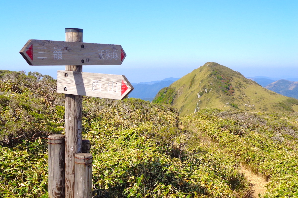
On maps this trailhead is usually called “Tenguzuka Trailhead”, however I would only be passing by this trailhead since it is only for people who can drive there. The trailhead I would be going to (Izari-touge Trailhead, which is accessible by bus), is a bit beyond Tenguzuka Trailhead.
Descending to Tenguzuka Trailhead
Anyway, from the trail junction just follow the trail downwards. It is pretty clear and fairly straight, but it is also a little steep, so be careful if it is wet from rain.

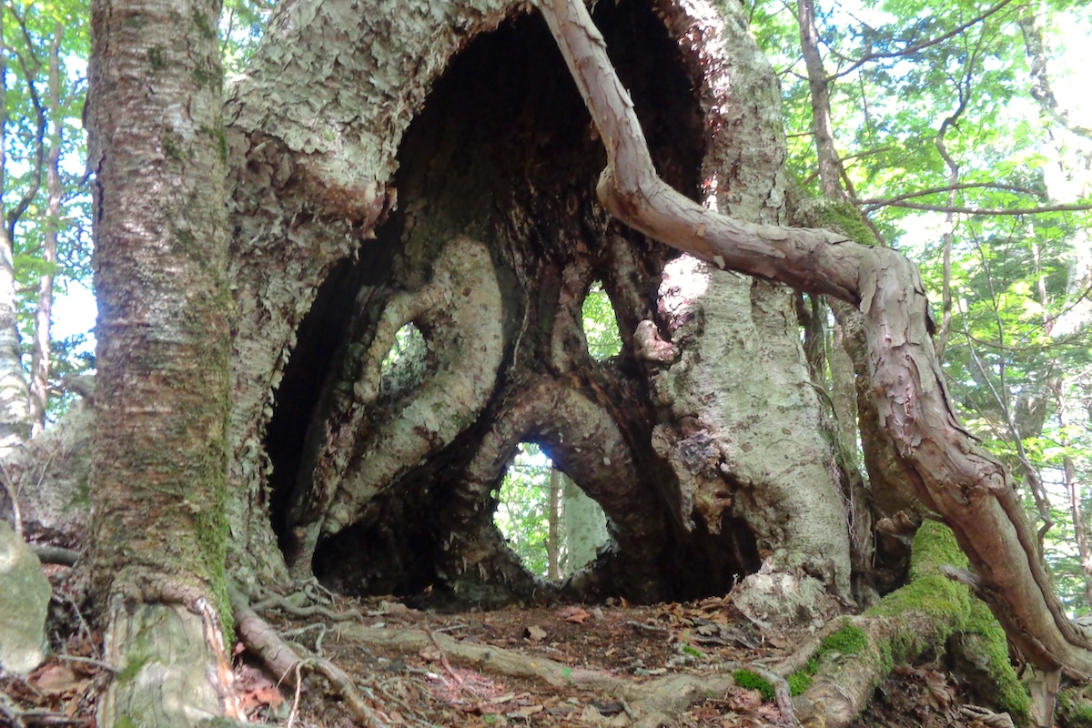
After about 10 minutes you enter the forest, and another half hour after that you reach two small uphill sections that are close together. Close to the top of the first hill, off to the right side of the trail is a neat looking “Screaming Tree” which looks like a face due to some natural holes in it (there is no sign for it, so just look around. It is easy enough to find).
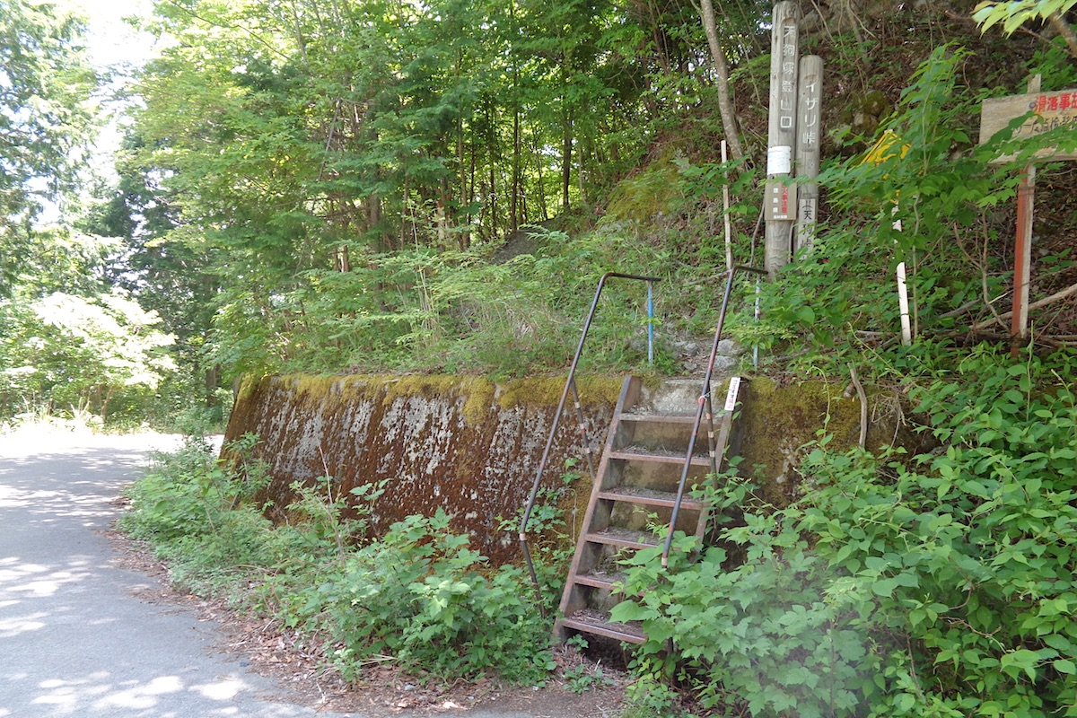
The trail continues downward in a clear way for another 30 or 40 minutes, and then you reach the main “Tenguzuka Trailhead”. This point can be accessed via a mountain road and most people who are only climbing the mountain for the day will usually drive to here.
There is a set of metal stairs to access the trail and a few signs, but there are no facilities at this trailhead (no toilet, no water, no shelter of any kind). On the roadside here is parking for several cars.
The final descent to Izari-touge Trailhead
Directly across the road from the stairs leading up the mountain is the trail for going further down to the lower trailhead. The first 15 meters it is pretty wide, and then it seems to split to the right and left. Go to the right here, and follow the wide section for another 20 or 30 meters.
You will then see some ribbons on the trees for where the trail fully enters the forest and begins to go steeply down.
Understand, this trail is not commonly used, so it is not as nicely maintained as other trails from the past 2 days. So be sure to constantly look for the tree ribbons when it becomes a bit unclear so that you do not get lost.
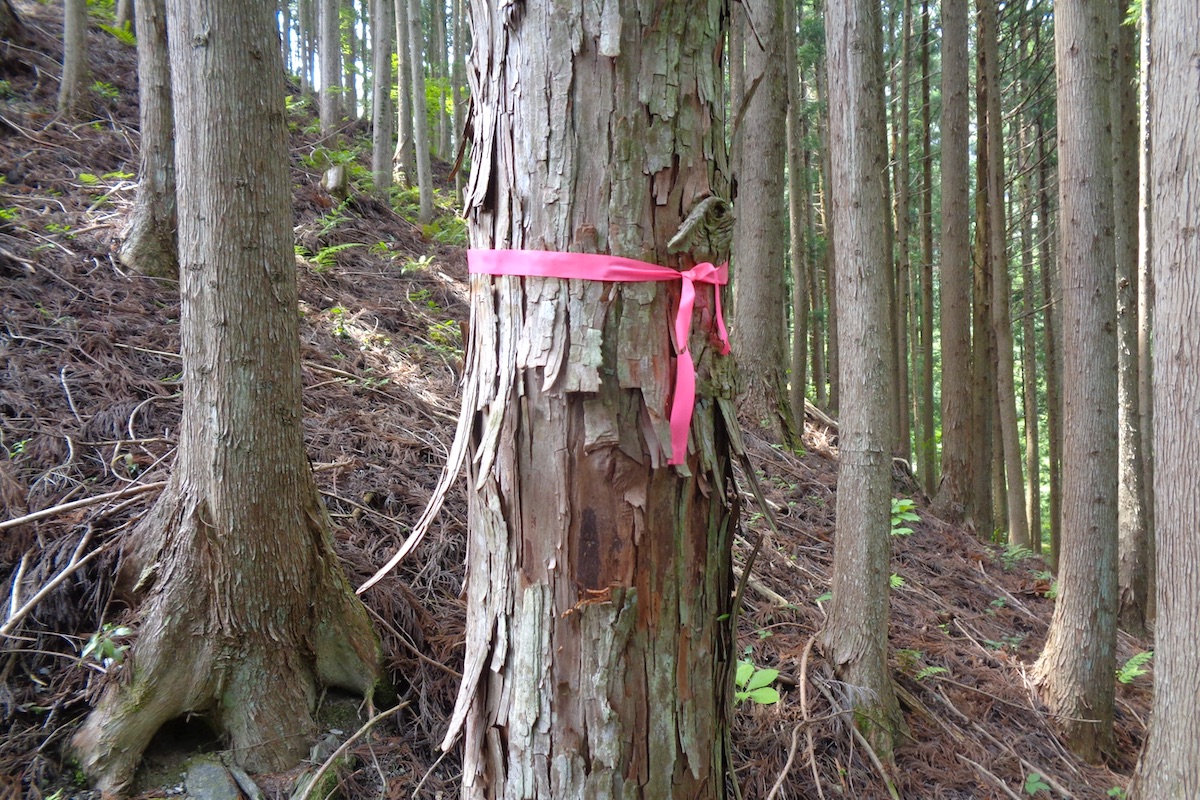
And be careful: there are many red/black stakes in the ground which mark land borders, but these are not for the trail. Yes, the trail does often follow the stakes along a land border, but sometime the stakes go in a different direction.
So if you stop seeing any tree ribbons, do not believe that you can just keep going down and that you will eventually find the path. Instead, go back up and find where you last saw a ribbon, and then try to find the correct way.
Anyway, the trail down is often steep and entirely in the forest. About 30-40 minutes down you pass over a small stream.
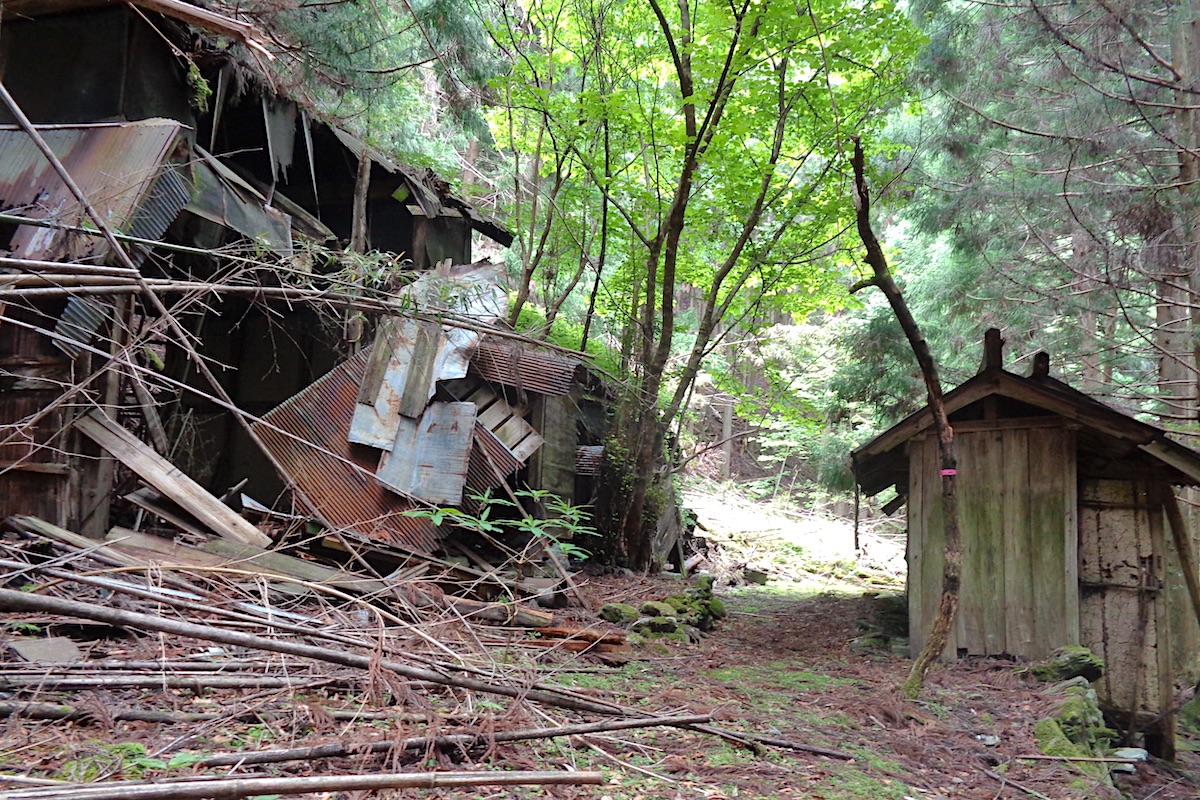
Soon after the stream you will see the roof of a collapsed building. The trail comes in just above this and then continues beyond by going between two more buildings which are (just barely) still standing.
The trail levels off for a while, and about 5 minutes from the old buildings you will see a bit of a clearing in the forest below the trail on the right. The trail turns right to go down here.
It is then another 5-10 minutes down through the forest, which brings you to Izari-touge Trailhead along the road.
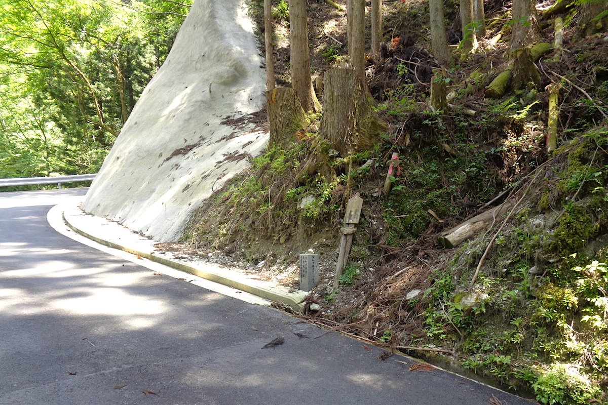
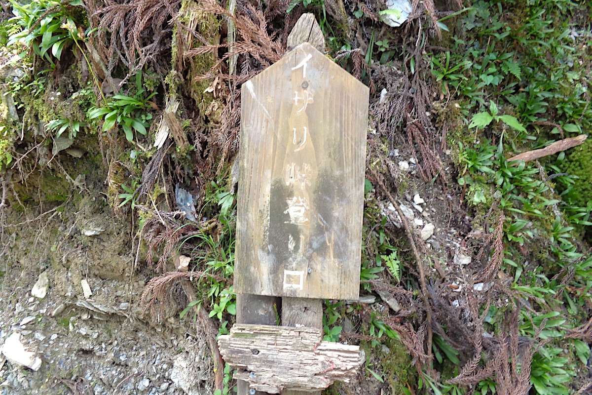
(For those doing this hike in reverse, Izari-touge Trailhead may be hard to find. There is only a faded old sign written in Japanese as “イザリ峠登山口“, and the trail goes up into the forest from between two concrete rock faces along the road).
The bus out from Kubo
From the trailhead, go down the road to the left towards a bridge. The road then follows a small river out until you cross another bridge which goes over the main Iya River. Going up the road another 50 meters leads to the public toilets just across from Kubo Bus Stop.
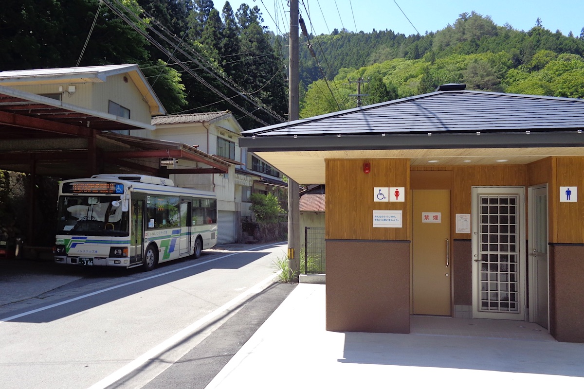
There isn’t really any shop or facility at Kubo other than the public toilets, so you probably want to bring some extra food for some lunch.
Buses depart Kubo going towards Oboke and Ikeda a few times a day. Most likely you would be taking one departing at either 12:24 or 14:24. These buses arrive at JR Oboke Station at 13:35 / 15:35, and then Awa-Ikeda Bus Terminal at 14:15 / 16:15.
Enjoy your hike!
More information:
For more info about this whole trail to/from Izari-touge Trailhead, including interactive maps in English, check the Mt Miune page on the IyaTime website:
https://www.iyatime.com/mt-miune
And bus schedules in English can be found here:
https://www.iyatime.com/bus-times
(Text & Photos by: Shaun Lamzy)
Related Posts
-
Exploring Oboke Gorge – Part 2 | A Place for Food, Fun… and Monsters?!
The thrilling cliffs of Oboke Gorge are formed by the mighty Yoshino River as it cuts its way throug
2023.03.21

-
Exploring Oboke Gorge – Part 1 | A Natural Wonder of Miyoshi City
The mighty Yoshino River flows across much of Shikoku, and as it cuts its way through the rugged mou
2023.03.20
-
Iya Kanko Ryokan – Part 3 | Inheriting the Tastes of the Iya Valley
Just a few minute walk from the famed Kazurabashi Vine Bridge, the Iya Kanko Ryokan has been welcomi
2023.03.19
-
Iya Kanko Ryokan – Part 2 | A Family-Run Business Where Life is a Juggle
The Kazurabashi Vine Bridge is one of the most renowned sights of the Iya Valley, and just a couple
2023.03.18
-
Iya Kanko Ryokan – Part 1 | A Traditional Inn near the Kazurabashi Vine Bridge
Acclaimed as one of Japan’s Three Unusual Bridges, the Kazurabashi Vine Bridge is one of the most fa
2023.03.17
-
The Shikoku “Yukigassen” Snowball Fight – Part 2 | The Heat of the Battle in Icy Conditions
The 19th annual “Yukigassen” Snowball Fight Tournament was held recently in the deep mountains of Mi
2023.02.19