


The Miune – Tenguzuka Traverse Part 3 | To Mt Nishikuma and Okameiwa Hut
2022.07.03
With some of the best hiking trails in Shikoku, the mountains surrounding Miyoshi City’s Iya Valley are where to go if looking for panoramic views and tranquil nature. In this multi-part series, we detail an intermediate yet challenging two day trekking route that is accessible by public bus, with staying overnight in one of the mountain-ridge huts.
previous post>>
The Miune & Tenguzuka Traverse Part 2 | Climbing the Mighty Mt Miune
The Miune & Tenguzuka Traverse Part 1 | A Two-Day Hike in the Shikoku Mountains
Iya’s South Ridge Trail
After a bit of a break on top of Mt Miune, I followed the trail to the west off of the summit.
A different trail goes off Miune summit to the south which then follows the ridge eastward to Mt Tsurugi. That route and the route explained here to Mt Tenguzuka can be combined to create a longer 3 day trek if you prefer. An article about that Tsurugi – Miune route can be found here:
https://miyoshi-city.jp/2021/10/10096/
But before setting off from Miune I put on a pair of long pants. I had hiked up in shorts since it was pretty warm, but for the next sections of the hike the trail goes through knee-high “sasa” grass, which has thick broad leaves and would scratch you legs considerably if not covered.
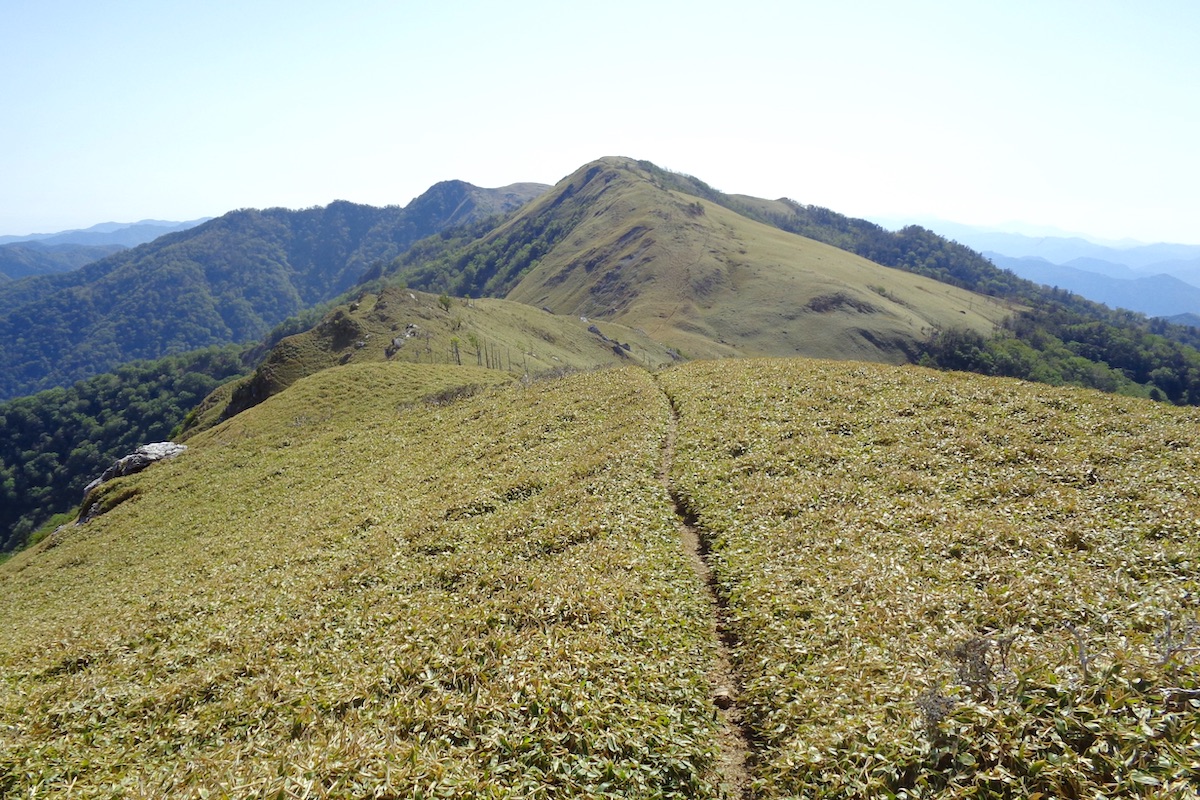
The trail westward goes down Miune peak for only a couple minutes and then goes up another small hill. The whole area is treeless, with only rolling pastures of sasa grass and expansive views beyond.
Engulfed by mountains
The trail then meandered slowly downward upon the rounded ridge. It was worth looking back once in a while to take in the beauty of Mt Miune, the sides of which were currently dotted with lots of blooming pink azalea bushes.
Perhaps one of the prettiest sections of the entire Iya South Ridge Trail, the views along here were endless.

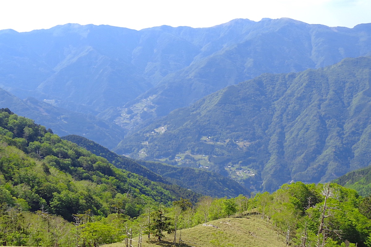
Off to the north it was also possible here to see the Iya Valley village of Kubo (tomorrow’s destination) and historic Ochiai Village just beyond it on the hillside.
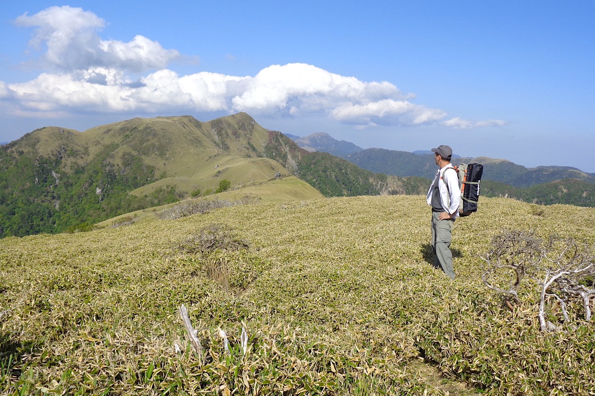
Ascending Mt Nishikuma
About a half hour from Mt Miune the trail reaches a low point, and then the slow climb up Mt Nishikuma begins.
The climb up is not too steep and it takes about 30 more minutes to reach the 1816 meter top of Mt Nishikuma.
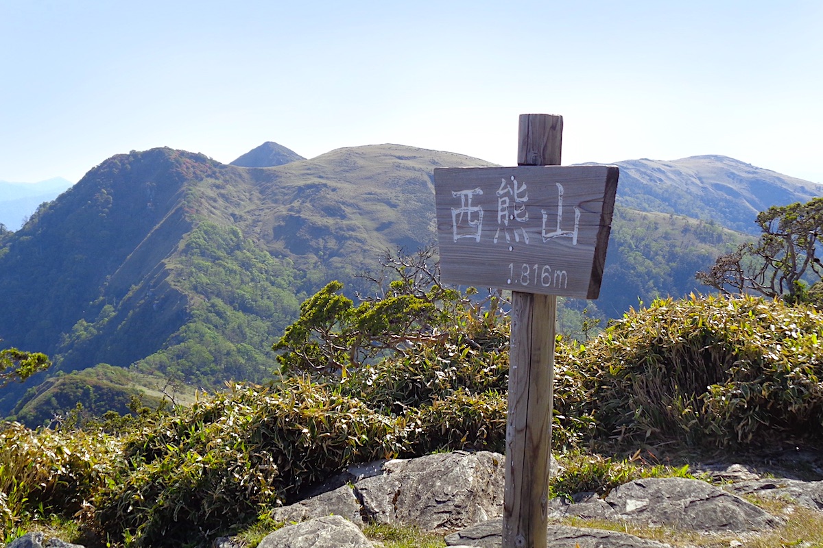
The views continued to be superfluously wonderful, and I took an extended break up here since this would be the final highpoint of the day. Looking further west along the trail, the triangular summit of Mt. Tenguzuka popped up just between the hills of the ridge.
Reaching Okameiwa Hut
From the top of Mt Nishikuma the trail goes steadily down for about 20 minutes and at the broad low-point a sign points off the ridge to the east for Okameiwa Hut.

Looking off the edge of the ridge the distinct red roof of the large wood hut immediately came into view, and the path down to it takes only a couple minutes.
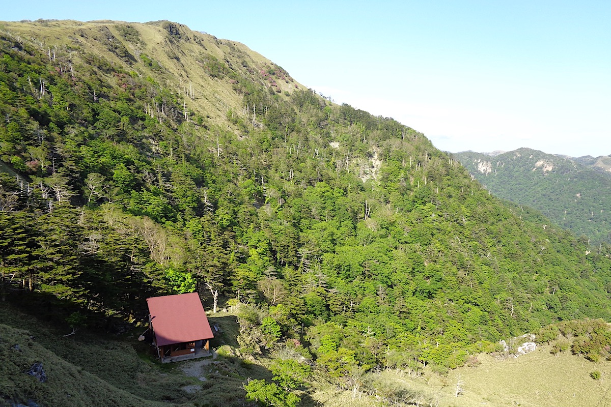
It was now about 4:00pm and I was ready to take my boots off to relax. This was the final destination for the day and where I would spend the night.
In Part 4, I explain the experience of staying at Okameiwa Hut.
next post>>
The Miune – Tenguzuka Traverse Part 4 | Staying at Okameiwa Hut
More Information
For more info and maps in English about this trail as well as the whole Iya South Ridge, check the Mt Miune page on the IyaTime website:
https://www.iyatime.com/mt-miune
(Text & Photos by: Shaun Lamzy)
Related Posts
-
Exploring Oboke Gorge – Part 2 | A Place for Food, Fun… and Monsters?!
The thrilling cliffs of Oboke Gorge are formed by the mighty Yoshino River as it cuts its way throug
2023.03.21

-
Exploring Oboke Gorge – Part 1 | A Natural Wonder of Miyoshi City
The mighty Yoshino River flows across much of Shikoku, and as it cuts its way through the rugged mou
2023.03.20
-
Iya Kanko Ryokan – Part 3 | Inheriting the Tastes of the Iya Valley
Just a few minute walk from the famed Kazurabashi Vine Bridge, the Iya Kanko Ryokan has been welcomi
2023.03.19
-
Iya Kanko Ryokan – Part 2 | A Family-Run Business Where Life is a Juggle
The Kazurabashi Vine Bridge is one of the most renowned sights of the Iya Valley, and just a couple
2023.03.18
-
Iya Kanko Ryokan – Part 1 | A Traditional Inn near the Kazurabashi Vine Bridge
Acclaimed as one of Japan’s Three Unusual Bridges, the Kazurabashi Vine Bridge is one of the most fa
2023.03.17
-
The Shikoku “Yukigassen” Snowball Fight – Part 2 | The Heat of the Battle in Icy Conditions
The 19th annual “Yukigassen” Snowball Fight Tournament was held recently in the deep mountains of Mi
2023.02.19