


Hiking Mt Kunimi -Part 3 | Descending the “Old Trail” to Oboke Station
2022.10.28
With an elevation of 1409m, Mt Kunimi sits on the border of the Oboke and Iya Valley sections of Tokushima’s Miyoshi City. With its name translated as “Country View”, Mt Kunimi offers panoramic views in every direction across the mountains of central Shikoku and is one of the most easily accessed mountains in the area.
previous posts
Hiking Mt Kunimi -Part 1 | An Exhilarating Easy-Access Day Hike
Hiking Mt Kunimi -Part 2 | Reaching the Summit for Amazing Views
Enjoying the Mt Kunimi summit
On the summit of Oboke I took an extended break upon the rocks here and had lunch amongst the impressive view. Back down at Oboke Station before departing for the mountain I had purchased a bento at Boke Mart.
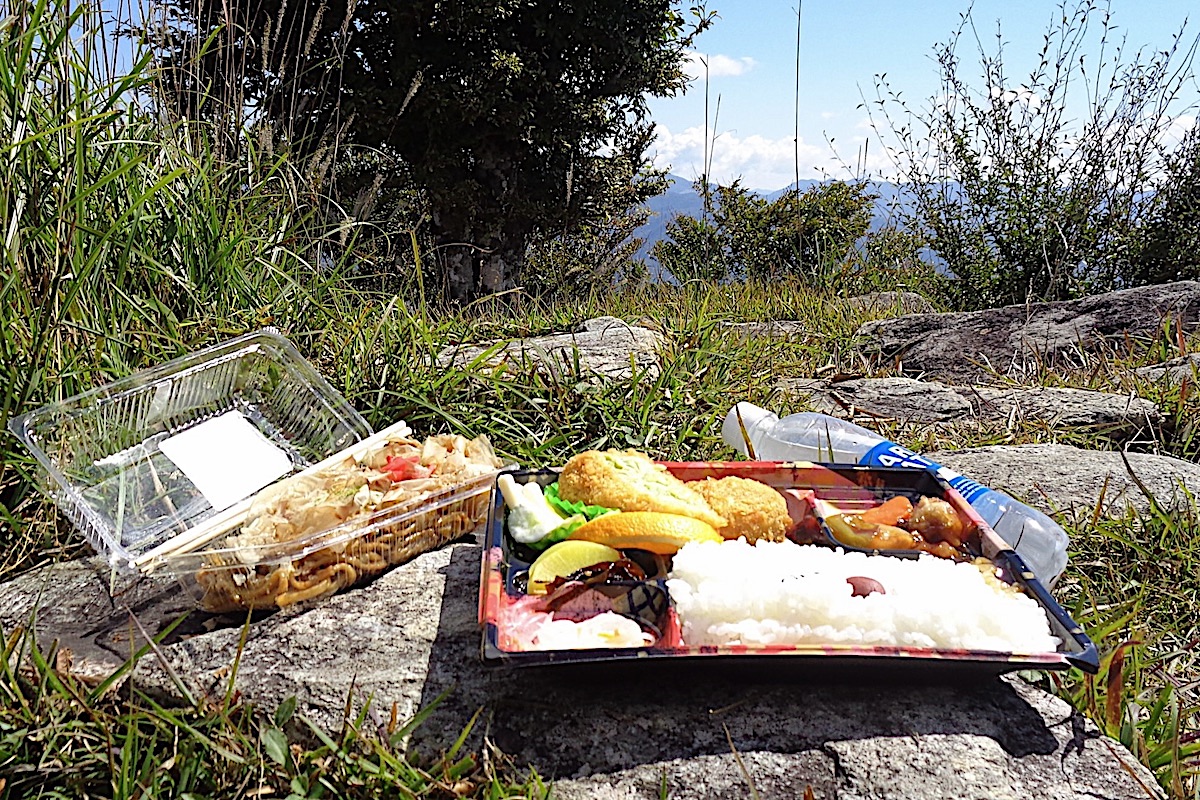
I also got some freshly made yaki-soba to have on the side since I knew I would be hungry.
Feeling satisfied and rested, I took in the panorama one final time before the long descent back to Oboke Station.

Taking the Old Kunimi Trail down
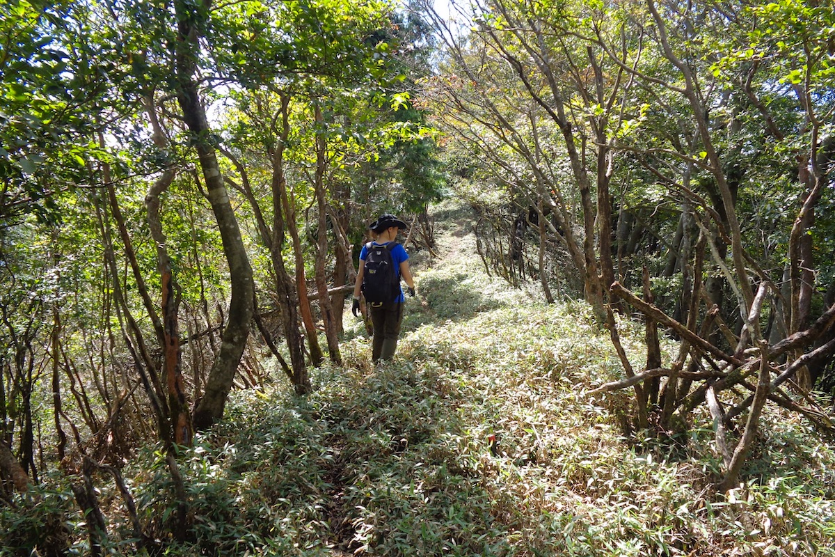
Going back on the trail from where I came up, a minute or so below the summit there is a trail junction. Going left here leads back to the shelter hut and then back to the Upper and Lower Trailheads, and going straight leads down along the “Kunimi Old Trail” (“国見 古道”) towards Oboke Station.
From the trail junction near the summit, the Old Trail leads steadily down through the forest. It can be a bit steep sometimes but not too bad, and since there was a typhoon a week before, there were several fallen branches upon the entire trail to Oboke.
Every once in a while there are some printed signs (in Japanese) from the Kunimi Sky Race, which is a trail running competition that is held here in late November. It is a particularly challenging course where runners start at Oboke Station, run up this trail to the summit (a 1200m elevation climb), then loop down over to the Upper Trailhead, go across the logging road, then run back down the Old Trail to Oboke Station.
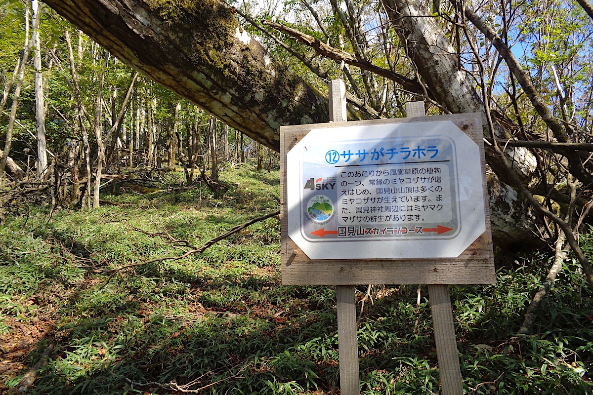
Aside from being impressive that people can actually complete this route (as will be explained, it gets quite steep) but the winner last year ran the whole 12.8km course in only 1 hour 35 minutes! An article explaining last year’s race can be found here:
https://miyoshi-city.jp/2021/12/11300/
About 30-40 minutes down the Old Trail from the summit you will reach the logging road.
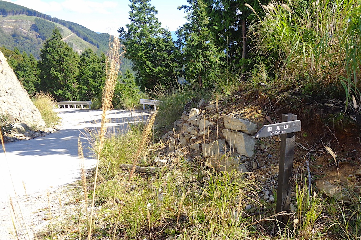
Follow the logging road down for about 200 meters. At a sharp left curve in the road which seems to be cut into the mountain, on the right is a small hill with a small antenna on top.

Just past the small hill is a rather hard to see sign on a dark brown wood post that says “Mt Kunimi” in English and Japanese. This marks where the trail goes down from the road.
It is easy to miss this sign and trail, so be careful.
The long way down to Oboke
Before setting out further on the Old Trail, be forewarned: this is not a simple walk in the woods. Despite being entirely downhill, if it is raining or you are not a confident hiker, or you are alone, you probably should not take this route.
Instead, follow the logging road about 2km over to the Upper Trailhead, and then hike back down to the Lower Trailhead and bus stop. The hike back from here takes about 1 to 1.5 hours.
A van-bus passes the Lower Trailhead at 15:59 to go back to Oboke Station. A final van-bus goes past at 16:54 going in the Iya Valley direction, then once back on the main road in Iya you can get off the van to then take a regular bus back to Oboke Station.
The Old Trail down from the road is long and often steep, and takes a further 2.5 hours to reach the bottom (unless of course, you are running). The initial half hour or so isn’t too bad, and at one point there is a fenced off section which is for protecting a rare species of plant. The badly marked trail here goes to the left of the fenced area and it goes a bit up a hill.
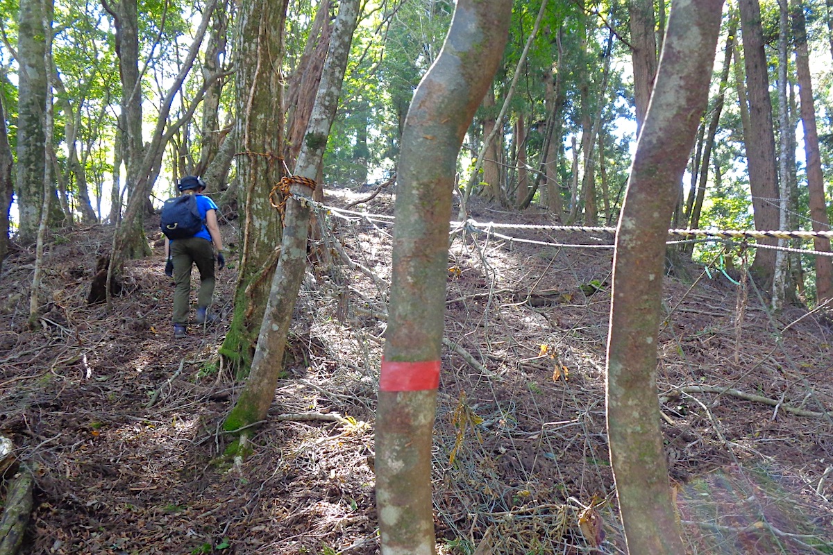
Just after the fenced area the trail is hard to find since there are only sporadic markers, but it heads down the other side of the hill to the left.
For the next few hundred meters, it is steep. Very steep. I mean seriously, it is very very very steep, making it all the more amazing that people actually run up this.
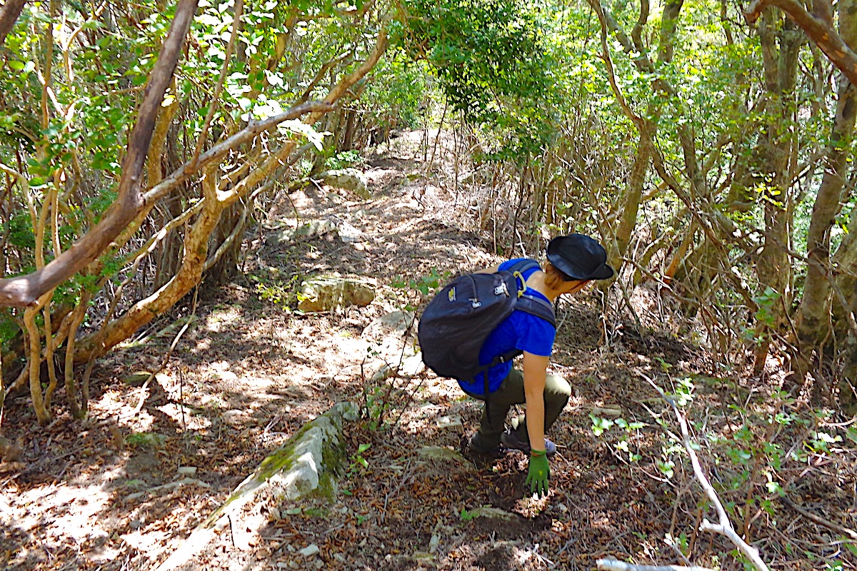
Once at the bottom of this section a Sky Race sign explains that this is the steepest part of the trail (but it is certainly not the only steep part).
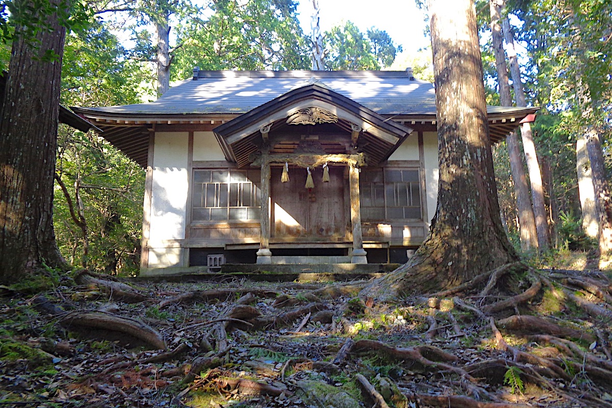
Deep forest and secret shrines
The trail does level off a bit from here and you then enter a dense forest of cedar trees. Due to the recent typhoon the ground was carpeted with still green cedar branches, giving it an otherworldly feel.
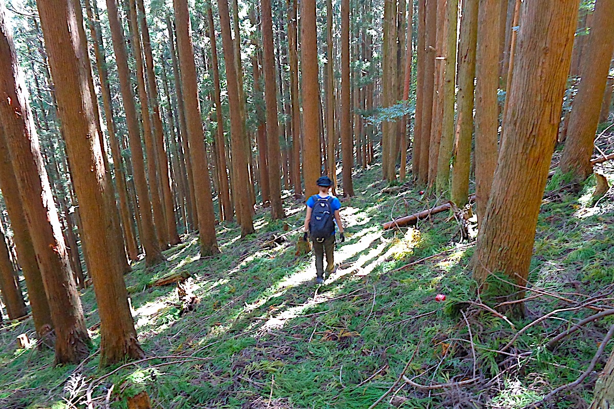
Along this section the trail goes off the ridge and starts to descend the hillside face of the mountain. The steepness increases as you move along, and within another 30 minutes or so the trail is once again going down rather sharply.
Continue descending, rather steeply at times, and after a couple more kilometers you will reach the back side of the isolated Arinomiya Shrine. This secluded little spot has lovely exposed tree roots all around the front of it.
From the shrine, follow the long stretch of stone steps down to a road. The trail is a little tricky to follow from here. Looking out over the road, on the other side there are several rows of tea bushes and a house beyond them to the right.
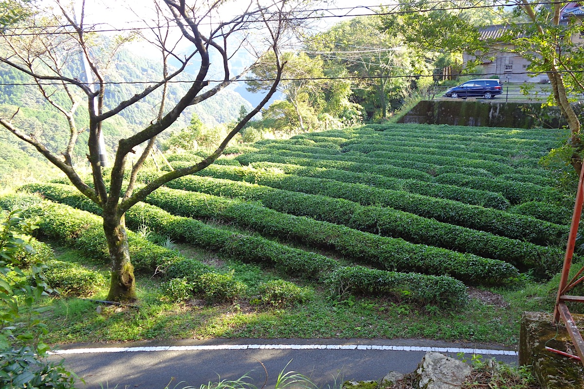
The trail goes to the left around the back side of those tea bushes, and this is reached by going to the left along the road for about 20 meters, then taking the even more narrow side road that then goes down off to the right here. Just 10 or 15 meters or so down this small side road you will see a white metal railing that goes up the concrete embankment to the right.

Follow the railing and path up upon the concrete and you will be then walking behind (and below) those tea bushes. A bit further along this path you will soon pass a large historic landmark sign for a beautiful but crumbling historic house (do not enter because people still live here).
Returning to Oboke Station
From here the trail becomes easily visible. Follow it down to cross another road about 200 meters from the historic house. From that road the trail goes another 200 meters through the forest to come out just above the Oboke Bridge and the Yoshino River.
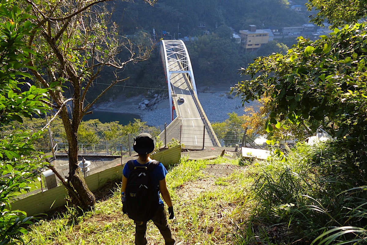
From here, the trail ends at another small road just beside a large water tank. Going left and then down some stairs leads directly to the main road (Rt 45) and Oboke Bridge, or follow this small road down to the right to reach the back side of Boke Mart.
Unless you have a train to immediately catch, you will certainly be getting a much deserved cold drink and snack from Boke Mart to enjoy out back on their patio space that overlooks JR Oboke Station. Well done!

Mt Kunimi Sky Running Race
If you have the mettle and actually want to run this ridiculously steep course in November, info for the Kunimi Sky Race can be found here:
https://human-power.wixsite.com/shikoku-skyrunning/events
or here:
Mt Kunimi Hiking Info
For hiking maps and trail info in English, check the Mt Kunimi section of the IyaTime website’s Hiking Portal:
https://www.iyatime.com/hiking-portal#Kunimi
For local bus schedules, check the IyaTime Bus Timetables page (the bus stop for Kunimi Lower Trailhead is listed as “Touge” on here):
https://www.iyatime.com/bus-times
(Text & Photos by: Shaun Lamzy)
Related Posts
-
Exploring Oboke Gorge – Part 2 | A Place for Food, Fun… and Monsters?!
The thrilling cliffs of Oboke Gorge are formed by the mighty Yoshino River as it cuts its way throug
2023.03.21

-
Exploring Oboke Gorge – Part 1 | A Natural Wonder of Miyoshi City
The mighty Yoshino River flows across much of Shikoku, and as it cuts its way through the rugged mou
2023.03.20
-
Iya Kanko Ryokan – Part 3 | Inheriting the Tastes of the Iya Valley
Just a few minute walk from the famed Kazurabashi Vine Bridge, the Iya Kanko Ryokan has been welcomi
2023.03.19
-
Iya Kanko Ryokan – Part 2 | A Family-Run Business Where Life is a Juggle
The Kazurabashi Vine Bridge is one of the most renowned sights of the Iya Valley, and just a couple
2023.03.18
-
Iya Kanko Ryokan – Part 1 | A Traditional Inn near the Kazurabashi Vine Bridge
Acclaimed as one of Japan’s Three Unusual Bridges, the Kazurabashi Vine Bridge is one of the most fa
2023.03.17
-
The Shikoku “Yukigassen” Snowball Fight – Part 2 | The Heat of the Battle in Icy Conditions
The 19th annual “Yukigassen” Snowball Fight Tournament was held recently in the deep mountains of Mi
2023.02.19