


Hiking Mt Kunimi -Part 1 | An Exhilarating Easy-Access Day Hike
2022.10.18
With a name that means “Country View”, Mt Kunimi offers panoramic views in every direction across the mountains of Shikoku from its location in the center of Tokushima’s Miyoshi City. Hiking trails for this 1409m high mountain are easily accessible from either JR Oboke Station or the Iya Valley.
A tall mountain in a hidden region of Tokushima Prefecture
It was a fine early autumn day when I set out to climb Mt Kunimi. With the hot humid days of summer finally finished, I had been looking forward to getting back out on the trails of the remote Miyoshi City.
With an elevation of 1409 meters, Mt Kunimi sits on the border of Miyoshi’s Oboke and Iya Valley areas, and it is the closest mountain to JR Oboke Station with panoramic views.
There are a few different routes to and from the summit, and in this series I will be explaining a course to/from JR Oboke Station using a local bus. But the trailheads are also accessible via your own car or taxi, and if you have the energy, it is even possible to hike all the way up from Oboke Station (explained in Part 3).
Accessing Mt Kunimi from Oboke Station
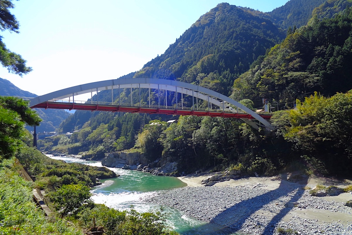
Located along the Dosan Train Line in central Shikoku, JR Oboke station is fairly small and is located inside a deep valley beside the mighty Yoshino River.

The river itself is just below the train tracks, with the Oboke Bridge crossing over above. On the other side of the tracks from the station there are a couple lovely viewpoints of the river and bridge.
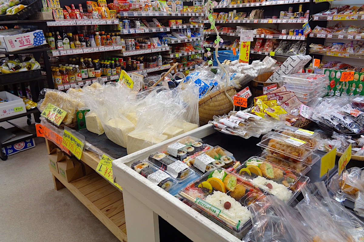
The bus to the hiking trailhead departs from just in front of the station, but before setting out I wanted to get some lunch and snacks. About 50 meters up the hill from the station is the small but well stocked Boke Mart, and I went there to get some supplies.

They have a pretty decent selection considering how isolated the area is, and they also make fresh bento lunch boxes as well as other fresh foods daily. There are also plenty of drinks and snacks available.
Properly supplied, I went back down to the station and the bus was ready to leave.
Note, this is not a normal “bus”, and is actually a large van. It is operated by Miyoshi City and used mainly for school kids, but anyone can ride as long as there is enough space (children will have priority).
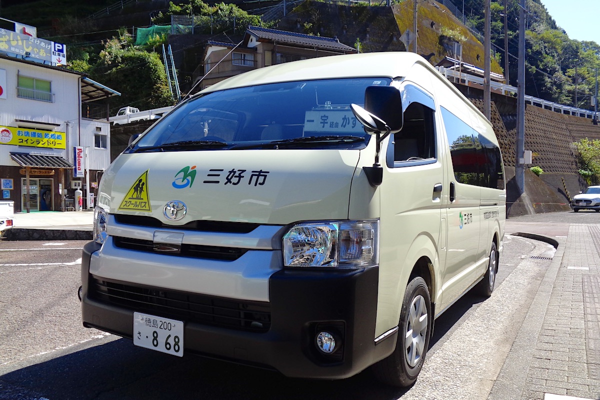
Since I was using the mid-day service departing Oboke Station at 10:42, it had only two other people on it. But there are only about 8 or 9 seats, so if you are coming with a larger group, it would be better to arrange a taxi.
Also, this van-bus only operates just a few times a day and it does not operate on Sundays or National Holidays. There are several other regular buses from Oboke Station which go daily in the same direction towards the Iya Valley, but those do not go to the Kunimi hiking trailhead. Only the local van-bus goes to the trailhead.
Kunimi Lower Trailhead at Oudou Pass
The bus ride to the trailhead takes about 20 minutes and costs 450 yen. Be sure to tell the driver when you get on that you want to go to “Kunimi-san” or to “Oudou Touge” (“touge means “mountain pass”).
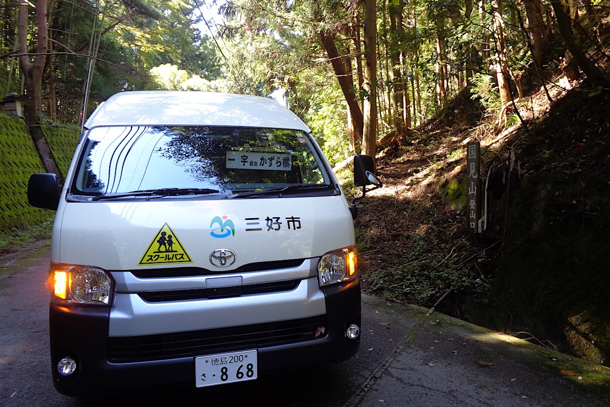
The pass and trailhead are within thick forest, and there is not much to be seen here along the road. There isn’t even a bus stop sign.
On one side of the road is a set of stairs which go up to an isolated Shinto shrine. It’s worth taking a quick walk up the steps to check out this secluded little sanctuary.
The trailhead is on the other side of the road from the shrine and a wood sign points up the trail for Mt Kunimi (“国見山”). This place is at an elevation of 781 meters, and from here it is a 1.5 to 2 hour climb to the 1409m top of Kunimi.
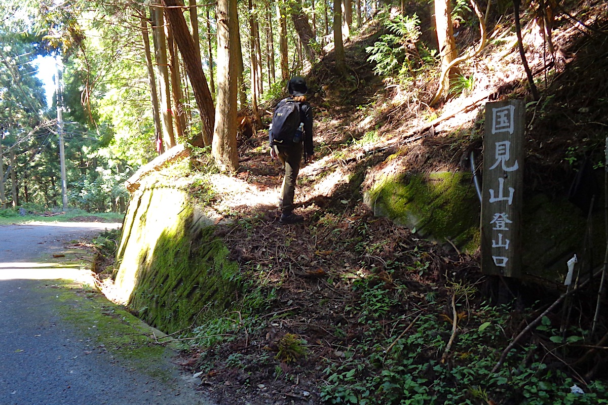
The trail to the Upper Kunimi Trailhead
From the Lower Trailhead, the trail is well marked with bright pink ribbons and it is easy to follow. It does climb constantly up and a few sections are somewhat steep, but it is not too difficult.
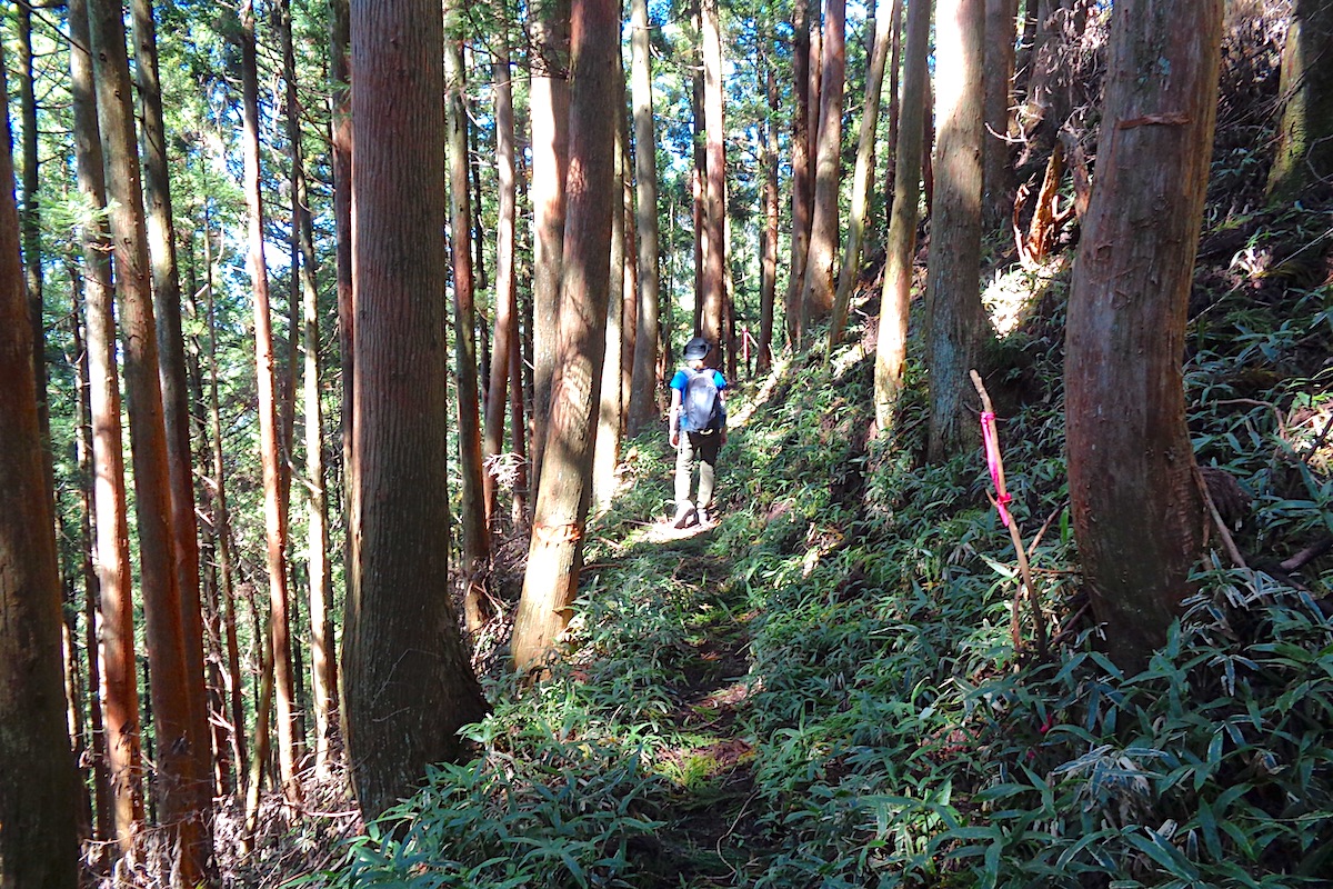
This entire section is within dense forest, and lots of birds can be heard chirping.
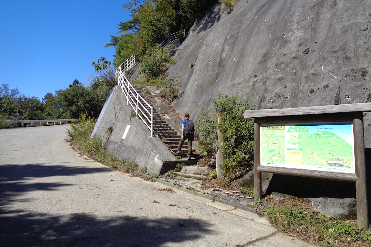
After about 40 or 45 minutes you will reach a paved logging road. This is the location of Kunimi’s 1040m high Upper Trailhead (it is also possible to drive up to this point if you have a car, but this road is not on many car navigation systems or Google Maps).
For more about about the drive up and for seeing early morning “Unkai” (Sea of Clouds) from this point, read about it here:
https://miyoshi-city.jp/2021/12/11037/
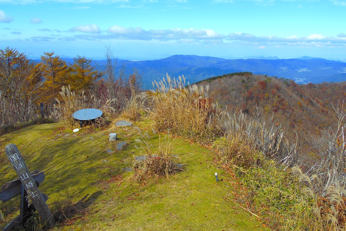
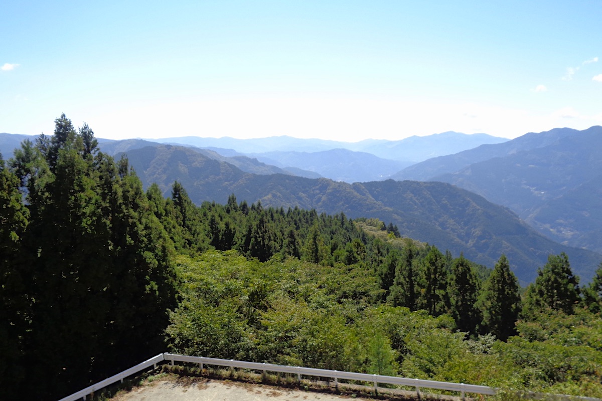
Panoramic views of the Yoshino River Valley
There is a wider parking area at the Upper Trailhead, but the view is a bit obstructed by trees along the road.
So for a better view, go up the stairs that are on the concrete wall next to the sign.
At the top of the steps, the view widens out above the trees and looks southward into the Yoshino River Valley and the expansive mountains of central Shikoku.
The rest of the trail up to Mt Kunimi continues from the top of the stairs, and in Part 2 I will explain the rest of the hike to the summit.
Mt Kunimi Info
For maps and trail info in English, check the Mt Kunimi section of the IyaTime website’s Hiking Portal
https://www.iyatime.com/hiking-portal#Kunimi
For the local van-bus to Lower Kunimi Trailhead, it does not operate on Sundays or National Holidays. From Oboke Station, it departs at 10:42am arriving at 10:59.
You can check the schedules on IyaTime’s Bus Timetables page (the bus stop for Kunimi Lower Trailhead is listed as “Touge” on here)
https://www.iyatime.com/bus-times
(Text & Photos by: Shaun Lamzy)
Related articles
>>Racing into the Sky – Part 1 | Miyoshi City Hosts the Mt. Kunimi Skyrunning Challenge
>>The Tsurugi – Miune Traverse | Hiking the Mountains of Miyoshi’s Iya Valley – Part 1
>>The Miune – Tenguzuka Traverse Part 1 | A Two-Day Hike in the Shikoku Mountains
Related Posts
-
Exploring Oboke Gorge – Part 2 | A Place for Food, Fun… and Monsters?!
The thrilling cliffs of Oboke Gorge are formed by the mighty Yoshino River as it cuts its way throug
2023.03.21

-
Exploring Oboke Gorge – Part 1 | A Natural Wonder of Miyoshi City
The mighty Yoshino River flows across much of Shikoku, and as it cuts its way through the rugged mou
2023.03.20
-
Iya Kanko Ryokan – Part 3 | Inheriting the Tastes of the Iya Valley
Just a few minute walk from the famed Kazurabashi Vine Bridge, the Iya Kanko Ryokan has been welcomi
2023.03.19
-
Iya Kanko Ryokan – Part 2 | A Family-Run Business Where Life is a Juggle
The Kazurabashi Vine Bridge is one of the most renowned sights of the Iya Valley, and just a couple
2023.03.18
-
Iya Kanko Ryokan – Part 1 | A Traditional Inn near the Kazurabashi Vine Bridge
Acclaimed as one of Japan’s Three Unusual Bridges, the Kazurabashi Vine Bridge is one of the most fa
2023.03.17
-
The Shikoku “Yukigassen” Snowball Fight – Part 2 | The Heat of the Battle in Icy Conditions
The 19th annual “Yukigassen” Snowball Fight Tournament was held recently in the deep mountains of Mi
2023.02.19