


The Tsurugi – Miune Traverse | Hiking the Mountains of Miyoshi’s Iya Valley – Part 6
2021.11.22
With continuous breathtaking views as it weaves along the ridge-line trail, the Tsurugi – Miune Traverse is one of the most majestic hiking routes in not just Miyoshi City, but in all of Shikoku. This 3 day (2 night) hike covers a total of about 25km and utilizes the mountaintop huts, with access to/from the trailheads by local bus.
previous posts>>
The Tsurugi –Miune Traverse | Hiking the Mountains of Miyoshi’s Iya Valley –Part 1
The Tsurugi – Miune Traverse | Hiking the Mountains of Miyoshi’s Iya Valley – Part 2
The Tsurugi – Miune Traverse | Hiking the Mountains of Miyoshi’s Iya Valley – Part 3
The Tsurugi – Miune Traverse | Hiking the Mountains of Miyoshi’s Iya Valley – Part 4
The Tsurugi – Miune Traverse | Hiking the Mountains of Miyoshi’s Iya Valley – Part 5
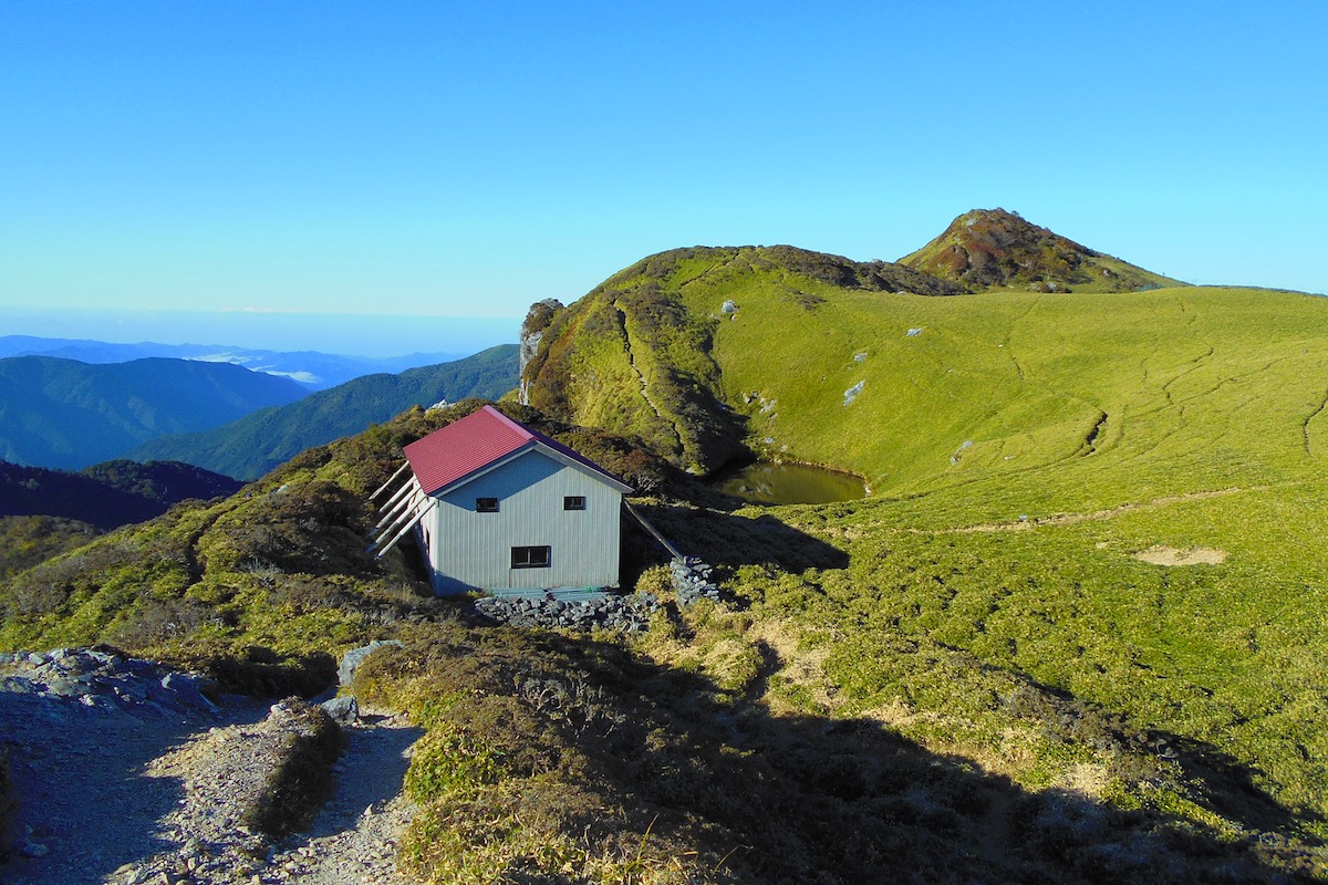
Along with everyone else at the Miune Hut, I was up before dawn to see the sunrise. The air was brisk and fairly calm, and standing on the ridge outside was amazingly tranquil.
From here the sun rose up from behind Mt Tsurugi and Mt Jirogyu far off in the distance, and as I looked out across the connecting ridge that I traversed the day before, I was impressed by the amount of distance I covered.

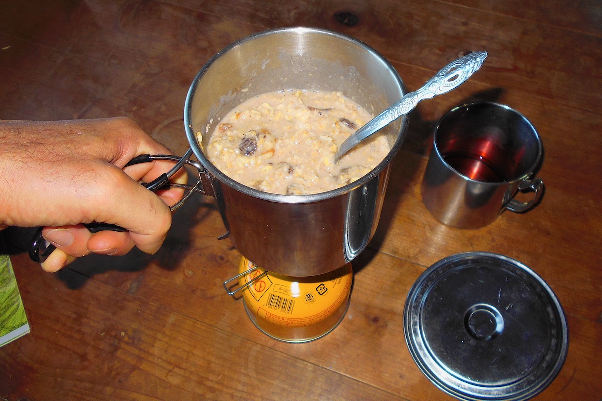
Back at the hut I made some coffee and prepared some breakfast. Like with dinner, simplicity was the goal, so I boiled up some oatmeal, which I prepared with some raisins, sugar, and a bit of cinnamon.
The morning was particularly clear, so I leisurely walked around the lake to take in the views and even went back up to the summit to observe the breathtaking panorama. There was no need to hurry since the bus out from Nagoro wouldn’t be departing for several hours.
The Final Leg Down to Nagoro Village
I packed my gear and then hiked down on the exit trail to the Miune Trailhead at Nagoro. The whole way down from Miune Hut takes about 2 to 2.5 hours (for those going in reverse it takes 3 to 3.5 hours to go up from Nagoro)
After about 10 minutes of steeply going down I again passed the water spring I went to the day before (for those doing this route in reverse by starting at Nagoro, be sure to get all the water you will need here on your way up since you won’t want to climb back down here later).
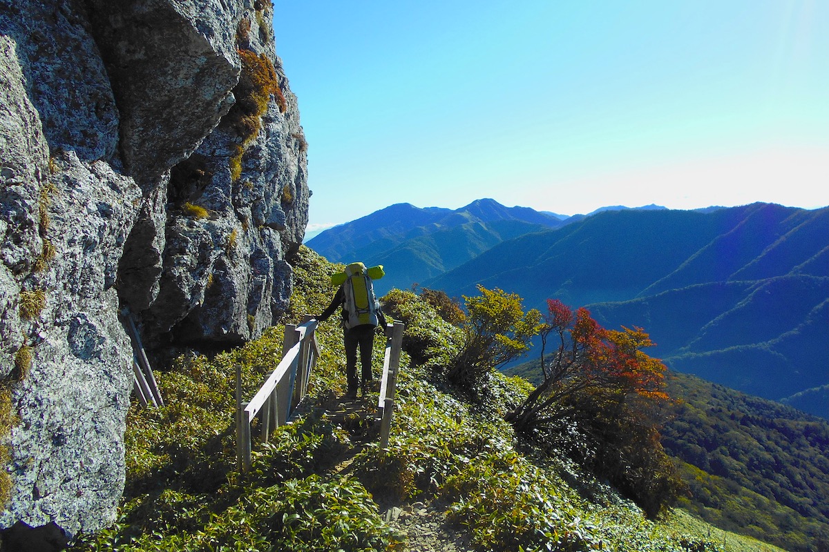
A few minutes after the water spring the trail enters the forest, and for the first hour or so it descends more gently along the ridge.
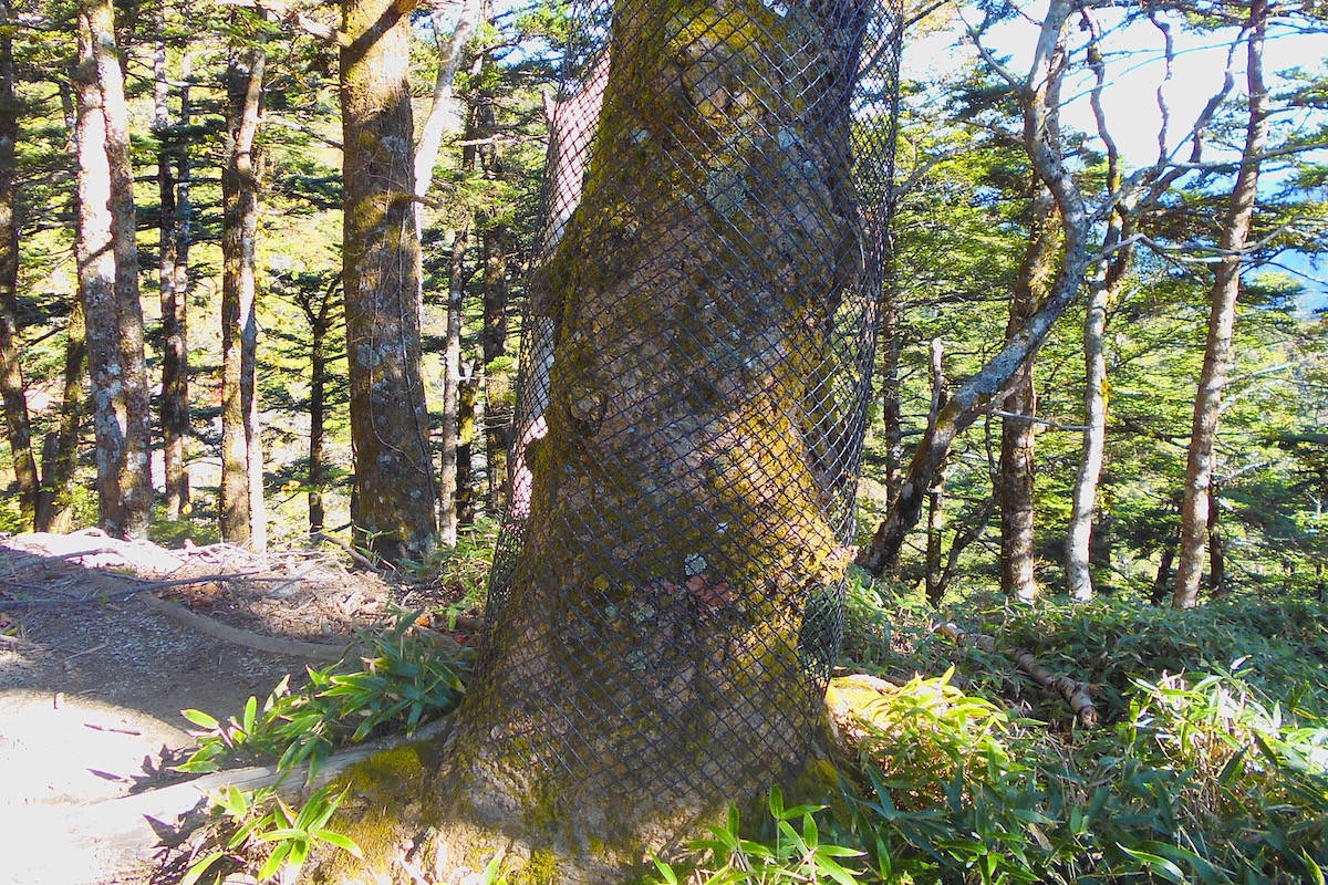
All through here, as with anywhere along the whole trail from Mt Tsurugi, you will notice some fencing both sectioning off areas as well as wrapped around trees. This fencing is here to prevent the over-abundance of deer from eating the tree bark, which will damage and eventually kill the tree.
For the final hour the trail descends more steeply through the forest, but it is clear enough to see. About 30 minutes from the bottom the trail crosses over a forestry access road.

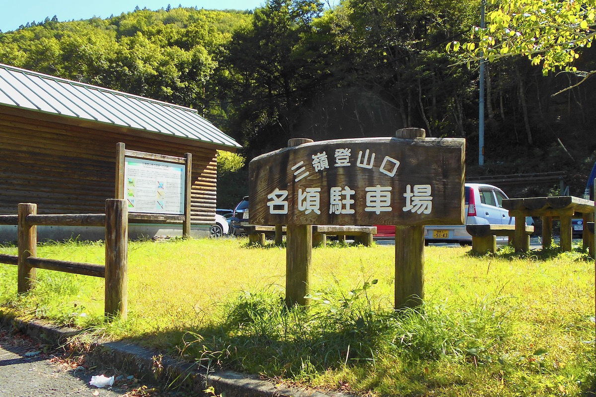
Once finally at the bottom, a small detour of sorts was set up since some construction was being done at the base here. So the end of the trail comes out onto an access road, and turning right here will lead about 100 meters along this road to the parking area for the Miune Trailhead at Nagoro.
The trailhead has lots of parking as well as toilets, water, and a small shelter hut (they all may be locked off season)
Departing the Iya Valley by Bus
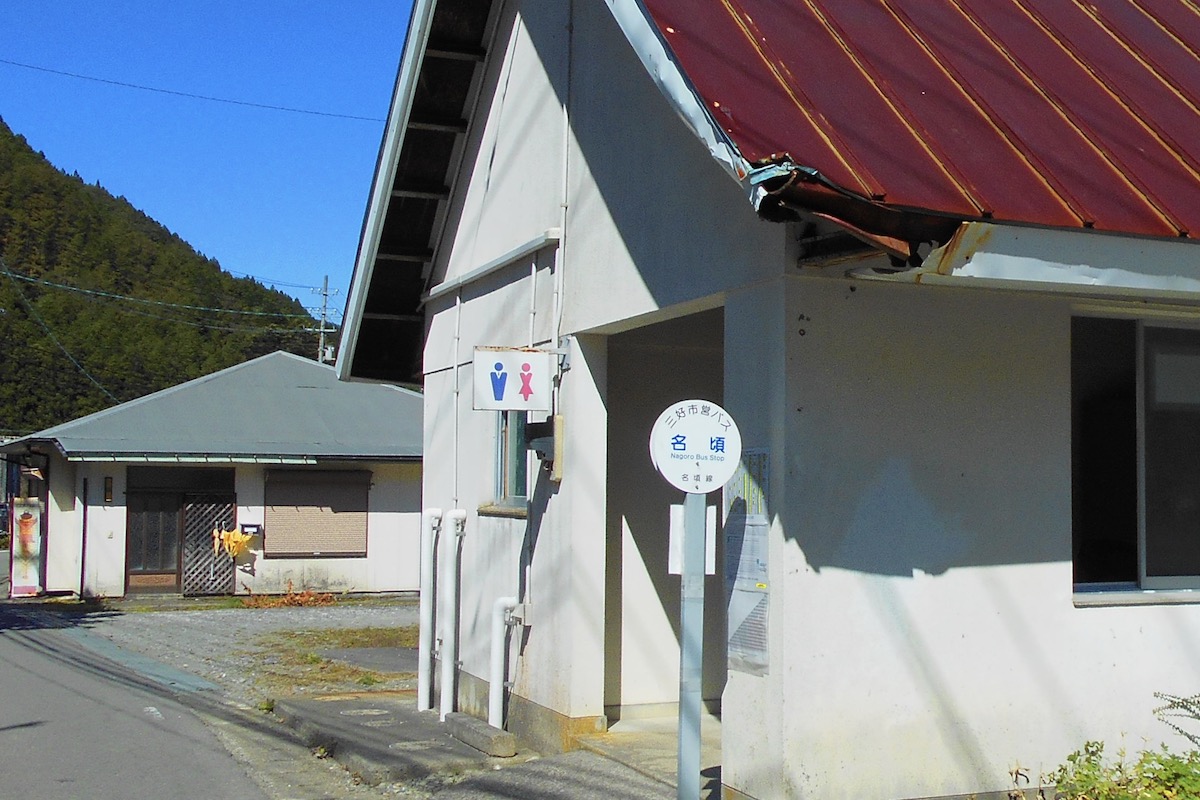
The Nagoro Bus Stop can be found by going out to the main road (RT 439) over the bridge and turning left. The bus stop is about 100 meters down the main road, and it also has toilets and a shelter hut.
The local Miyoshi Municipal Buses depart at 11:25 and 15:20, and these buses going down and out of the Iya Valley from Nagoro operate every day of the week all year (only the buses going beyond here up to Mt Tsurugi at Minokoshi operate on a seasonal, non-daily schedule).
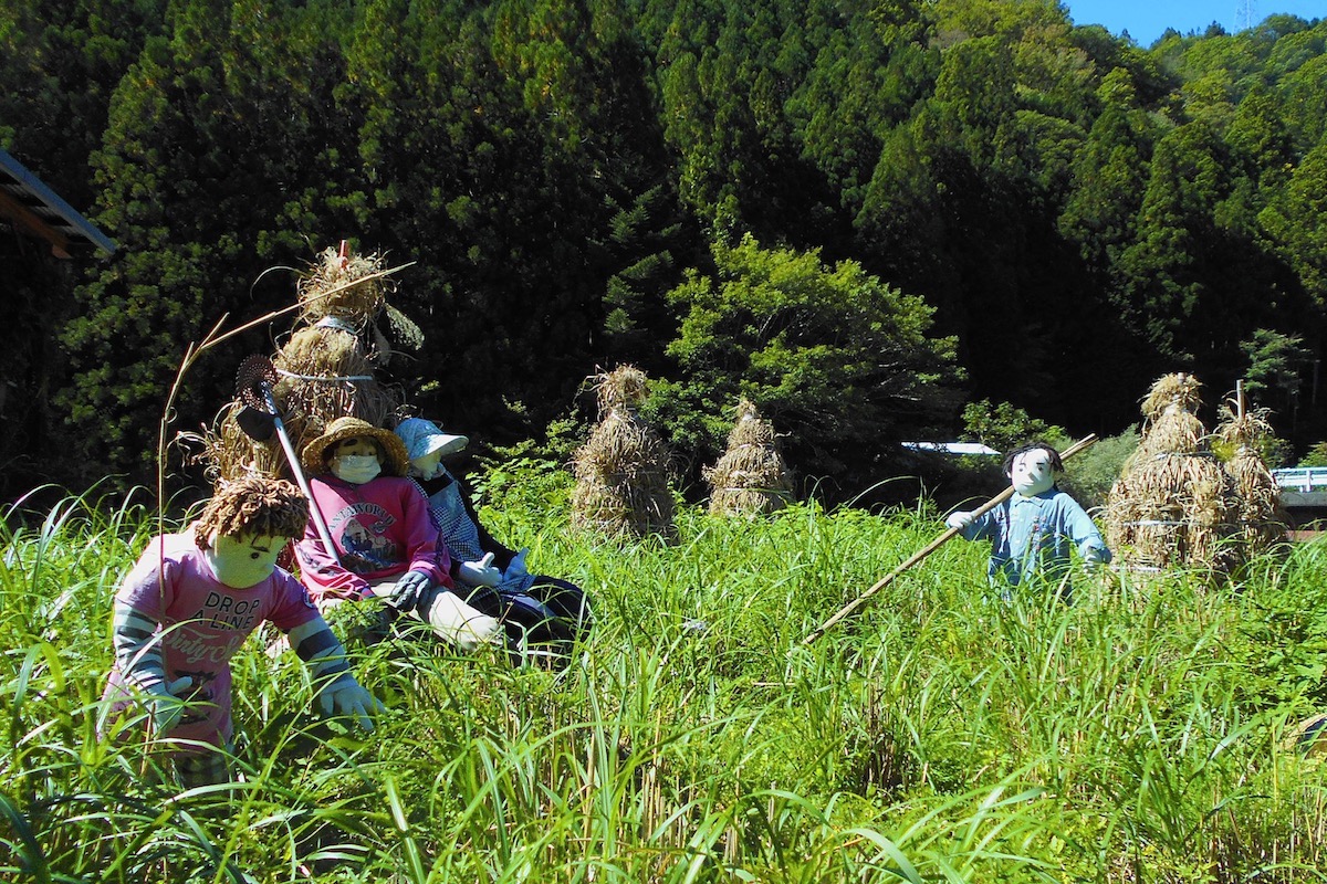
However, if you have some extra time, instead of waiting only at the bus stop, consider walking a further 100-200 meters beyond the bus stop into Nagoro Village, which is famously also known as the “Scarecrow Village” (“Kakashi-no-Sato”) since hundreds of life-sized dolls have been set all around here by a local artist.
But remember, as with coming in, when taking the bus from Nagoro you will need to transfer along the way onto the Shikoku Kotsu Bus to continue out to Oboke or Ikeda, however the matching times for the buses going out do not sync as well as with coming in.
The 11:25 bus from Nagoro gets to Kubo for the connection at 11:50, and the Shikoku Kotsu Bus departs Kubo at 12:24. It then arrives at JR Oboke Station at 13:35 and finally Awa-Ikeda Bus Terminal at 14:15.
Or for the 15:20 bus from Nagoro, it gets to Kubo at 15:45, and the Shikoku Kotsu Bus departs Kubo at 16:44. It then arrives at JR Oboke Station at 17:59 and then Awa-Ikeda Bus Terminal at 18:40.
Though this 3 day traverse is certainly a challenge and not really for beginners, it was very rewarding. It is particularly pretty in mid to late October when the leaves change color. However, if you don’t have the time or ability to do this route but you still want to enjoy the beautiful scenery, there are many hiking trails in the Iya Valley area which can be suitable for just about anyone!
For more information about access and hiking in the Iya Valley in English, including detailed trail maps, check the Hiking Portal page on the IyaTime website. Complete bus schedules in English can be found here as well.
https://www.iyatime.com/hiking-portal
For the Shikoku Kotsu Bus, their webpage (Japanese only) is here:
For the local Miyoshi Municipal Bus, info on this (Japanese only) is here:
https://www.miyoshi.i-tokushima.jp/kurashi/bus/
(Text & Photos by: Shaun Lamzy)
Related Posts
-
Exploring Oboke Gorge – Part 2 | A Place for Food, Fun… and Monsters?!
The thrilling cliffs of Oboke Gorge are formed by the mighty Yoshino River as it cuts its way throug
2023.03.21

-
Exploring Oboke Gorge – Part 1 | A Natural Wonder of Miyoshi City
The mighty Yoshino River flows across much of Shikoku, and as it cuts its way through the rugged mou
2023.03.20
-
Iya Kanko Ryokan – Part 3 | Inheriting the Tastes of the Iya Valley
Just a few minute walk from the famed Kazurabashi Vine Bridge, the Iya Kanko Ryokan has been welcomi
2023.03.19
-
Iya Kanko Ryokan – Part 2 | A Family-Run Business Where Life is a Juggle
The Kazurabashi Vine Bridge is one of the most renowned sights of the Iya Valley, and just a couple
2023.03.18
-
Iya Kanko Ryokan – Part 1 | A Traditional Inn near the Kazurabashi Vine Bridge
Acclaimed as one of Japan’s Three Unusual Bridges, the Kazurabashi Vine Bridge is one of the most fa
2023.03.17
-
The Shikoku “Yukigassen” Snowball Fight – Part 2 | The Heat of the Battle in Icy Conditions
The 19th annual “Yukigassen” Snowball Fight Tournament was held recently in the deep mountains of Mi
2023.02.19