


The Tsurugi – Miune Traverse | Hiking the Mountains of Miyoshi’s Iya Valley – Part 4
2021.11.08
With continuous breathtaking views as it weaves along the ridge-line trail, the Tsurugi – Miune Traverse is one of the most majestic hiking routes in not just Miyoshi City, but in all of Shikoku. This 3 day (2 night) hike covers a total of about 25km and utilizes the mountaintop huts, with access to/from the trailheads by local bus.
previous posts>>
The Tsurugi –Miune Traverse | Hiking the Mountains of Miyoshi’s Iya Valley –Part 1
The Tsurugi – Miune Traverse | Hiking the Mountains of Miyoshi’s Iya Valley – Part 2
The Tsurugi – Miune Traverse | Hiking the Mountains of Miyoshi’s Iya Valley – Part 3
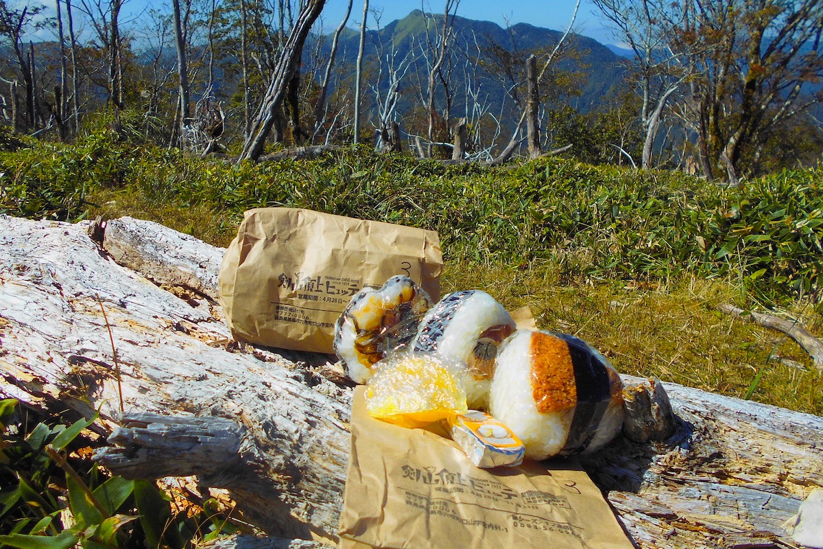
I opened up my packed lunch from the Tsurugi Chojo Hutte and my growling stomach was pleasantly surprised to find three hefty onigiri (rice balls) each with a different flavor, as well as some of their home-made pickles and a piece of cheese.
Mt Tsurugi to Mt Miune Traverse – Second Half
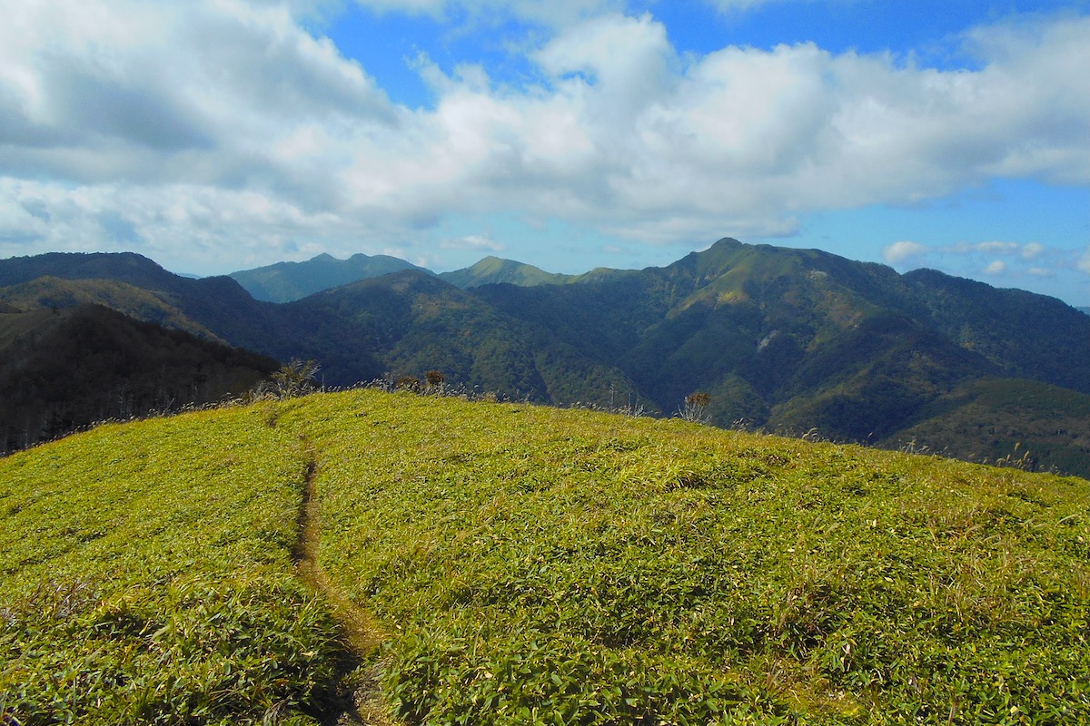
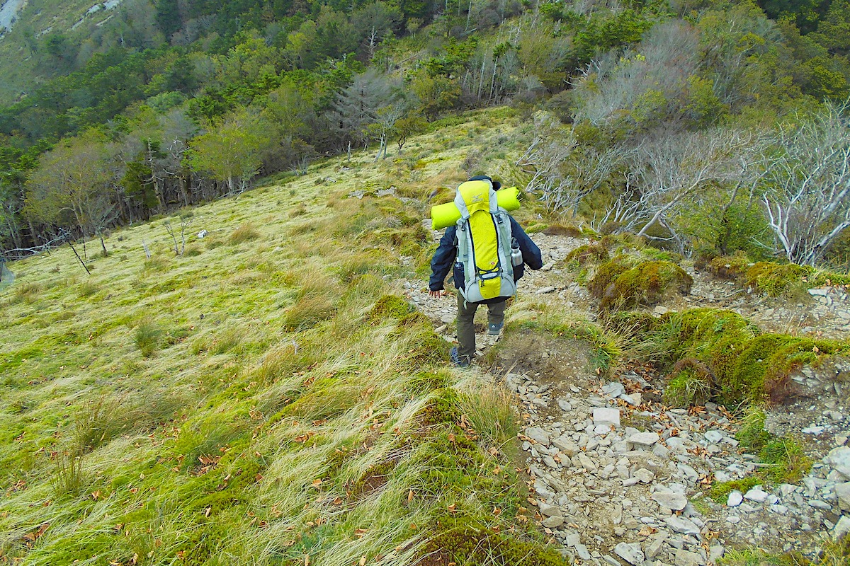
After eating, I set off back on the trail, which from here beautifully cuts itself along the grassy slopes of the ridge, first dipping down for a while and then slowly climbing back up. The grass in here is pretty thick and grows about waist high, so be careful with where you step and to not lose your way.
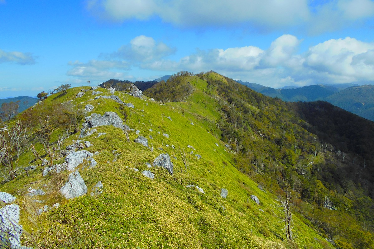
The panoramic views continue all through here as you pass over the gentle hill-top called Heiwa-maru at 1700 meters. As you pass through this area, down to the right it’s easy to see the village of Nagoro at the bottom of the valley below, which is the final end point for this hike tomorrow.
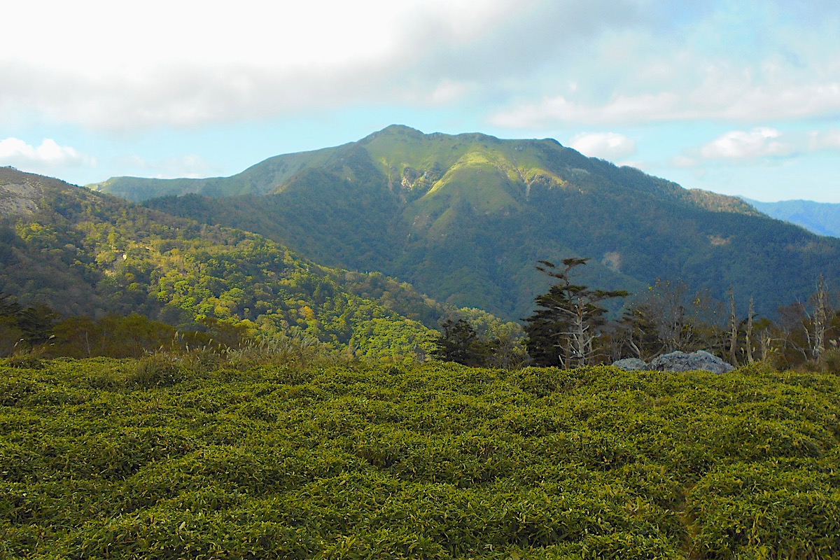
All the while, the massive south face of Mt Miune continually increases in size as you move ever closer, and another hour or so further along you will reach the small Shiraga Shelter Hut, which is the same as the Marushi Hut in being unstaffed with neither electric nor toilets.

However water can be found here, but it’s certainly not so easy to access. Just past the hut a side trail goes off to the left and then very steeply down the mountain. Within a minute or so you will begin to hear the water flowing in a stream off to the right, but you need to go steeply down for several minutes before being able to access it. It would also be advisable to filter or treat any water from here.
Back on the main trail, from the Shiraga Hut you need to go up for about 10 minutes to the turn off to Mt Shiraga at the top of a small hill (it takes about 45 minutes each way to go to the summit of Mt Shiraga).
From this trail junction, Mt Miune will now start to be directly in front of you, almost due north. The trail begins to go down, and for several points it can be a particularly steep descent. I was happy that the ground was dry when I went, because if it was raining and/or wet then it would have been rather precarious.
(If the weather becomes bad as you come through here, it is better to hide out back at Shiraga Hut because this is not the final hazardous point in the approach to Mt Miune).
After reaching the bottom about half an hour later you then begin the climb up a treeless hill called Kaya-hage, and you will reach its 1720m top in another 20 minutes or so. The towering presence of Mt Miune from here is unavoidable.
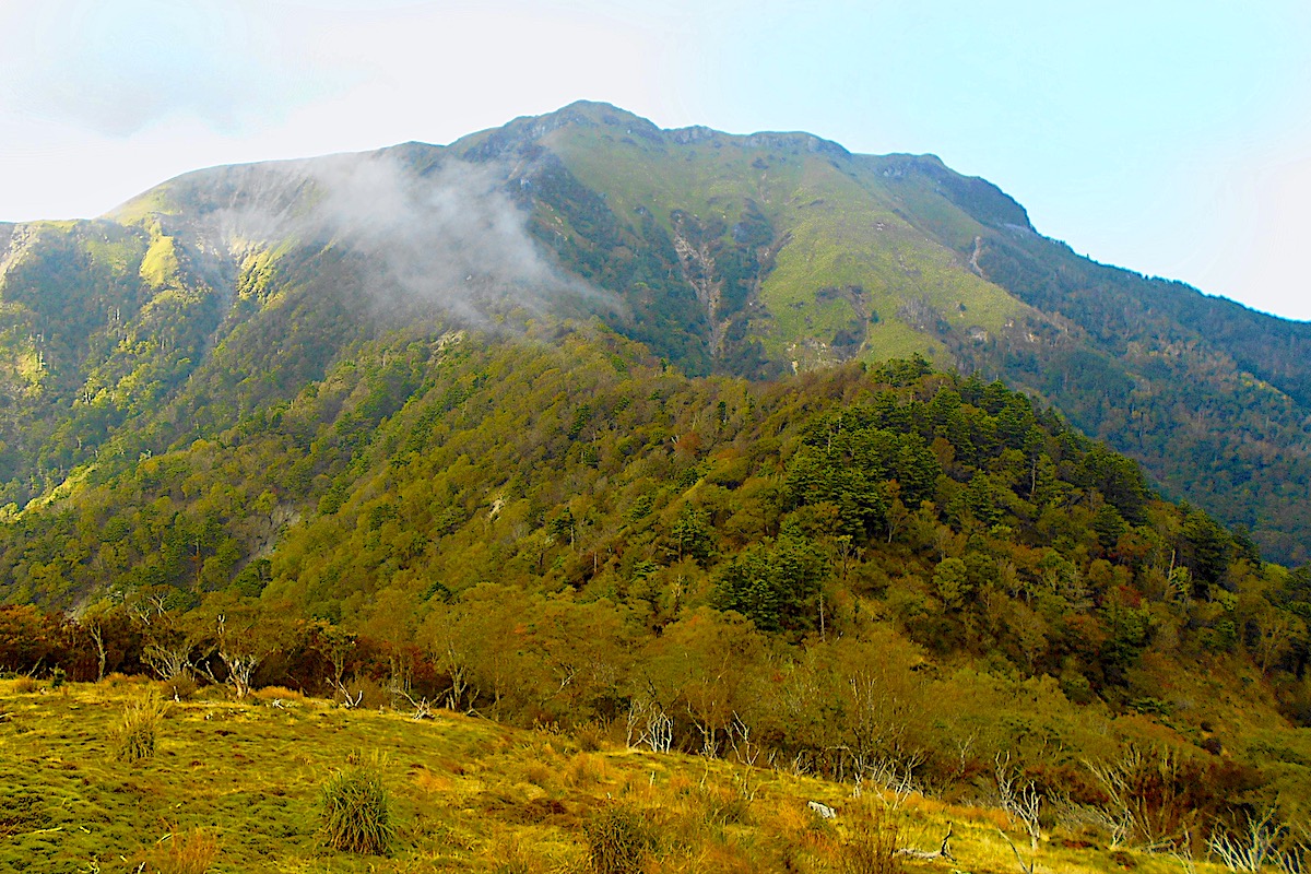
The trail goes down from here for another 30 minutes and then begins the final ascent up to Mt Miune. The forest along the ridge is quite pretty, but at one point you will begin to pass some distinct boulders where the trees then end and you are left with the exposed mountain face.
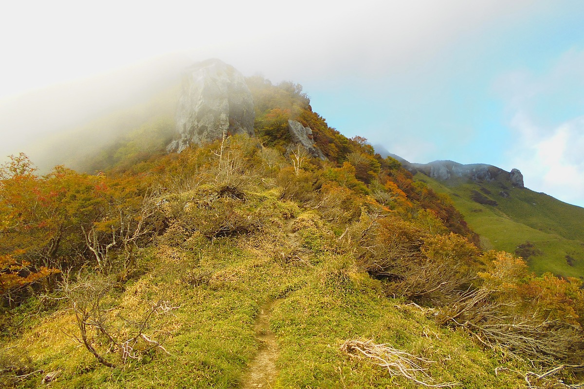
It was now late afternoon and some fog began rolling in over the summit of Mt Miune, which is actually a rather normal occurrence at this time of day. But it did mean I would be climbing into a vast white emptiness.
You will encounter the first set of chains as you pass some massive boulders. The chains are thankfully here to use for climbing since it is so steep, and your arms will immediately get a workout.
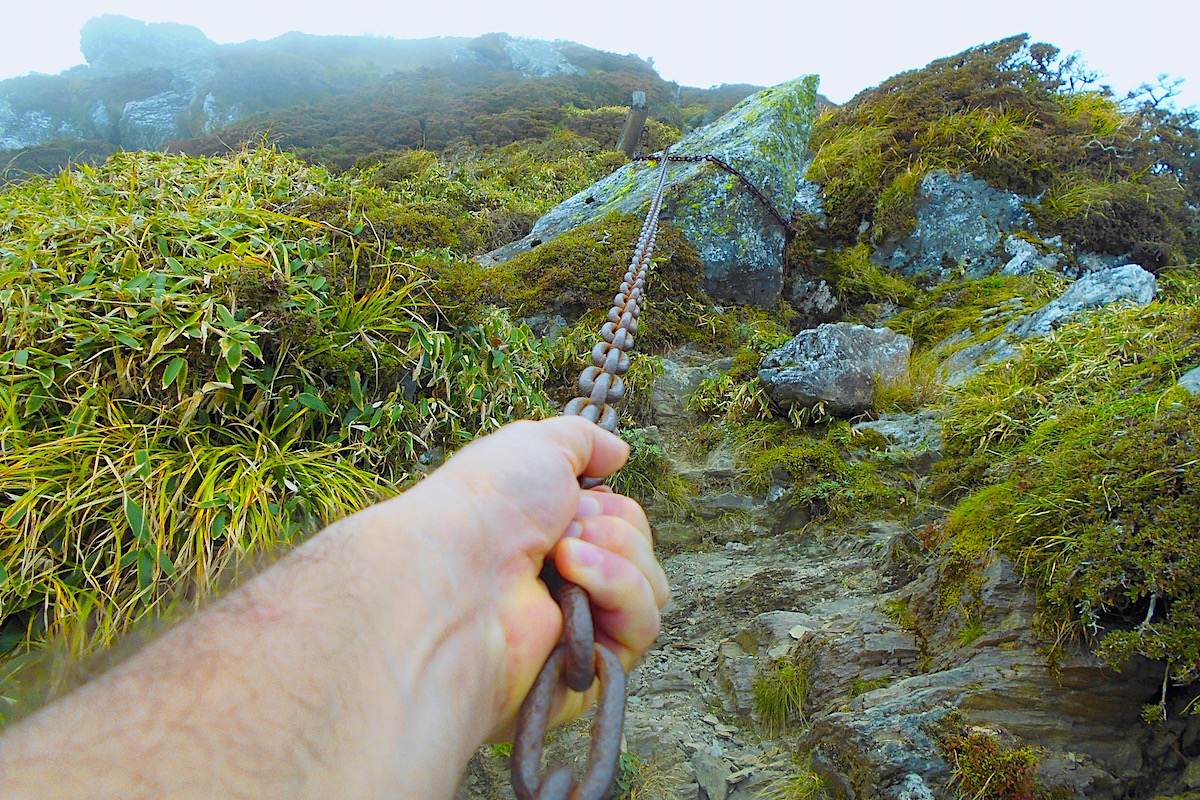
The trail then continues up for a bit where you will reach the next set of chains, and these chains welcomingly continue for quite a while as they go up the steep, tall stairs of the trail.
It was a slow and steady process to get up the mountain, and after 8+ hours of hiking I was pretty tired, so upon taking the final steps up to the 1893m summit of Mt Miune and taking off my backpack, I felt both relieved and triumphant.

In Part 5 of this 6 part article I will explain what it is like to stay at the wonderful Miune Hut.
For more information about access and hiking in the Iya Valley in English, including detailed trail maps, check the Hiking Portal page on the IyaTime website.
https://www.iyatime.com/hiking-portal
(Text & Photos by: Shaun Lamzy)
Related Posts
-
Exploring Oboke Gorge – Part 2 | A Place for Food, Fun… and Monsters?!
The thrilling cliffs of Oboke Gorge are formed by the mighty Yoshino River as it cuts its way throug
2023.03.21

-
Exploring Oboke Gorge – Part 1 | A Natural Wonder of Miyoshi City
The mighty Yoshino River flows across much of Shikoku, and as it cuts its way through the rugged mou
2023.03.20
-
Iya Kanko Ryokan – Part 3 | Inheriting the Tastes of the Iya Valley
Just a few minute walk from the famed Kazurabashi Vine Bridge, the Iya Kanko Ryokan has been welcomi
2023.03.19
-
Iya Kanko Ryokan – Part 2 | A Family-Run Business Where Life is a Juggle
The Kazurabashi Vine Bridge is one of the most renowned sights of the Iya Valley, and just a couple
2023.03.18
-
Iya Kanko Ryokan – Part 1 | A Traditional Inn near the Kazurabashi Vine Bridge
Acclaimed as one of Japan’s Three Unusual Bridges, the Kazurabashi Vine Bridge is one of the most fa
2023.03.17
-
The Shikoku “Yukigassen” Snowball Fight – Part 2 | The Heat of the Battle in Icy Conditions
The 19th annual “Yukigassen” Snowball Fight Tournament was held recently in the deep mountains of Mi
2023.02.19