


Enjoying Ochiai Pass – Part 2 | Short Yet Rewarding Hikes from Ochiai Pass
2022.10.05
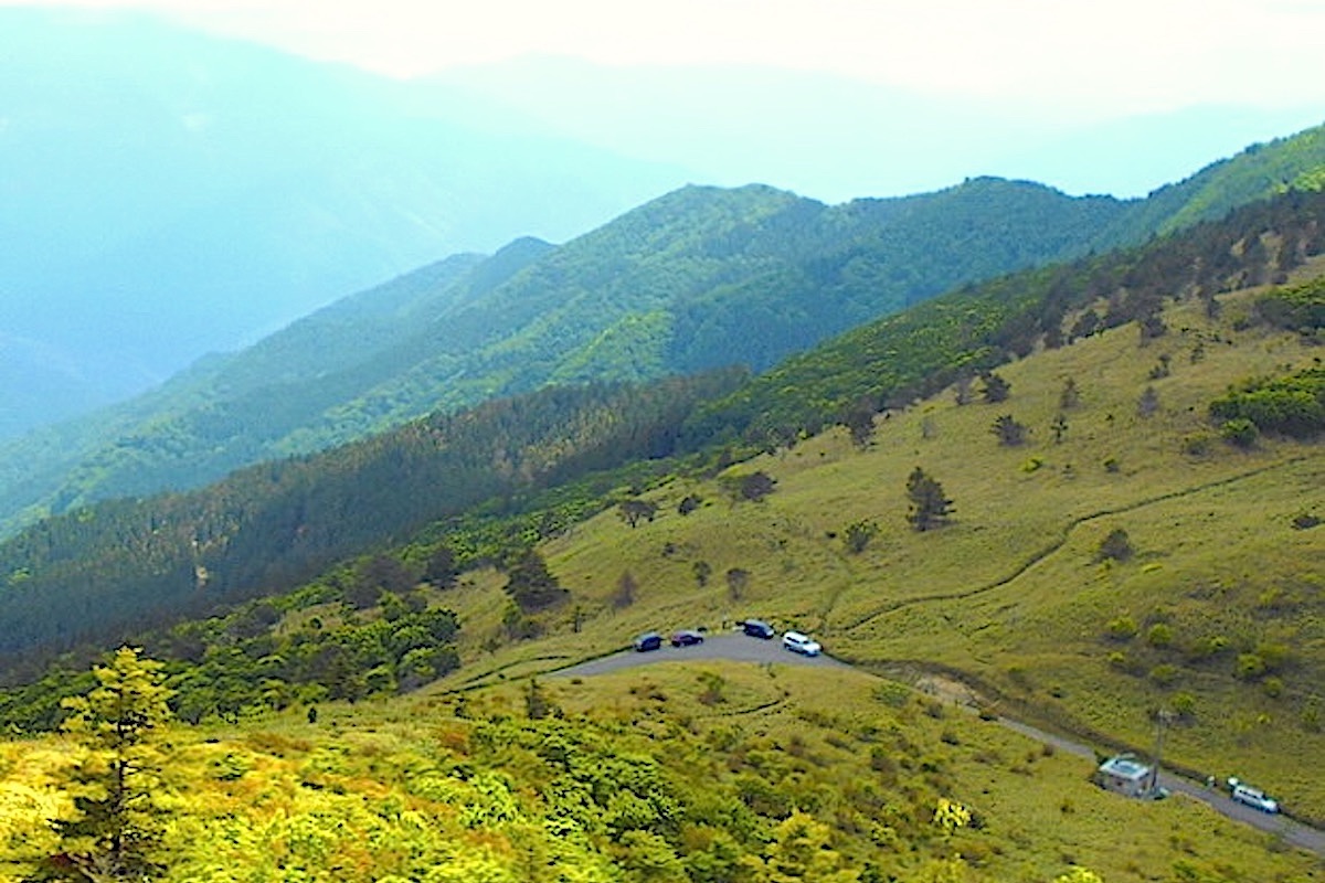
With panoramic views looking across the Iya Valley, the 1520m high Ochiai Pass is the highest drivable road in Tokushima’s Miyoshi City and the second highest mountain pass in Shikoku. Hiking trails leading off along the ridge offer even more expansive views.
previous post>>Enjoying Ochiai Pass – Part 1 | Panoramic Views of the Iya Valley and Shikoku Mountains
Seeking even better views of Shikoku’s Mountains
Along the road at the top of Ochiai Pass is also the point for the Ochiai Pass Trailhead, with trails going off in both directions from either side of the road.
Both trails head out along the ridge to neighboring mountains, but you do not need to hike all that far on either trail to reach some wonderful and fulfilling viewpoints.
In this article we will describe a couple short hikes for either direction that are suitable for even beginner hikers (though probably not for young children).
Ochiai Pass Overlook: short and steep
If not looking to hike too far but also looking to enjoy an impressive view, then the 10-15 minute hike up to Ochiai Pass Overlook would be where to go.
From the pass top, the trail for here goes to the east, and starts across the road from the pass marker sign. The uphill section begins almost immediately.
Actually the 1585m high overlook point you are heading for can be easily seen by looking up from the roadside.
The trail is clear and easy to follow, but it is constantly uphill and a little steep at times. There are not really any trees along here, just lots of thick sasa grass. The grass is about knee high and can scratch your legs if wearing shorts, so it would be best to wear long pants.
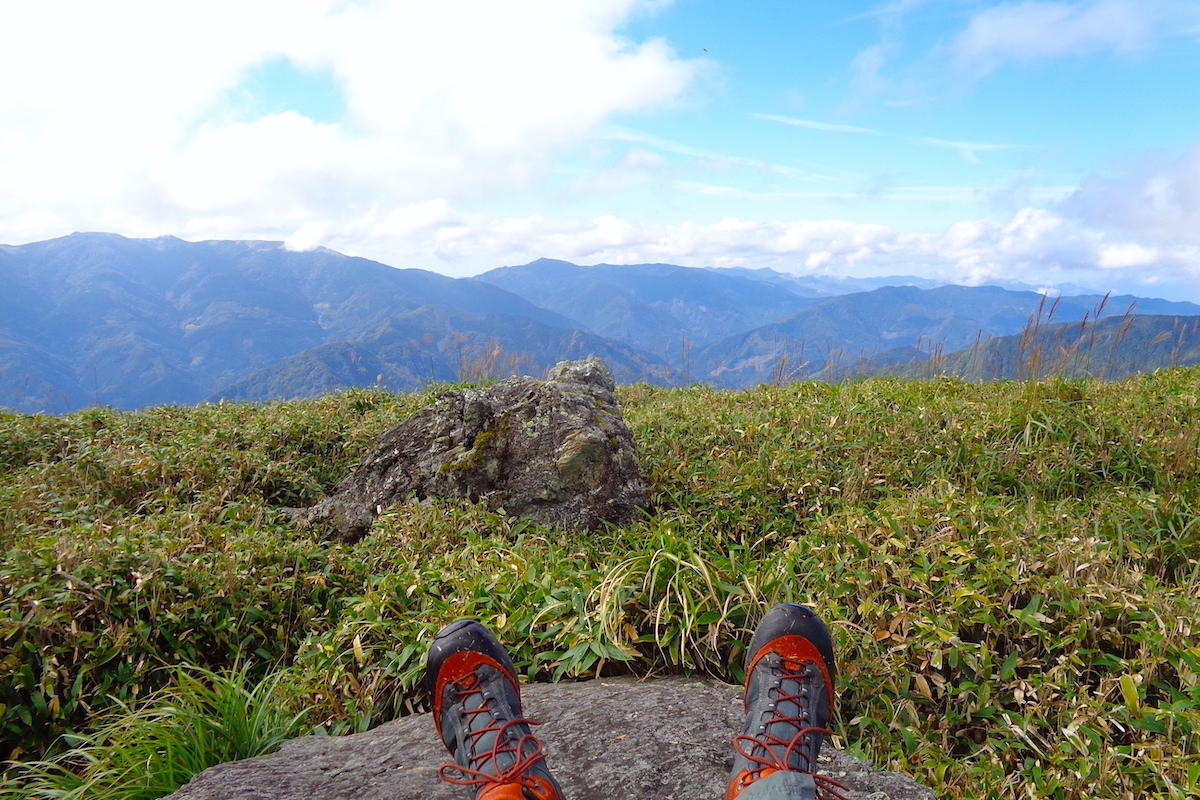
After the short yet exhilarating climb you will reach some exposed stones at the top.
Go to the left off the main trail past the stones through some even thicker sasa grass to reach a point overlooking Ochiai Pass. (If continuing straight on the trail it leads to Mt Yahazu about 1.5 hours away)
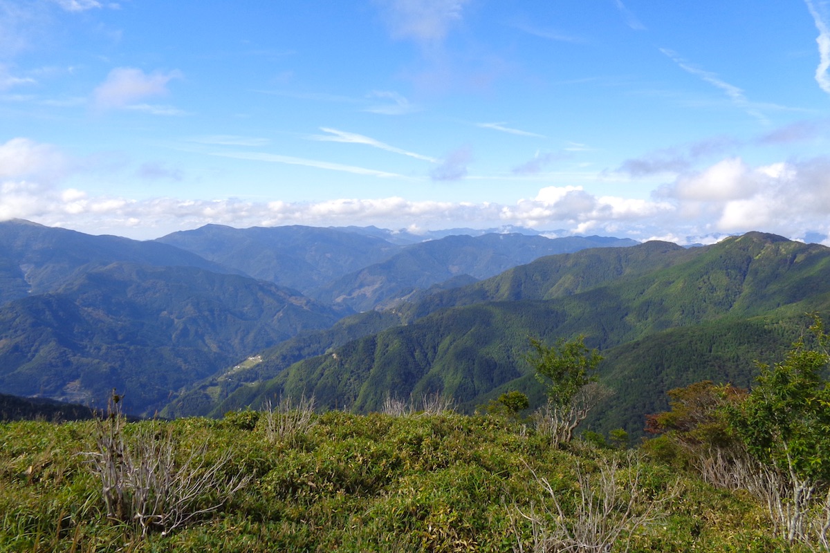
At the Overlook, have a break upon one of the stones to enjoy the impressive view, which now also extends further to the west and north across all of western Tokushima Prefecture and central Shikoku.
Ochi-hage Trail: a lovely highland landscape
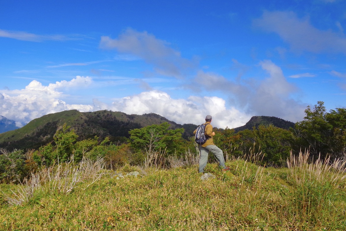
If looking for a little more exertion along a rather pretty trail, consider instead the 30-35 minute hike up to nearby Ochi-hage.
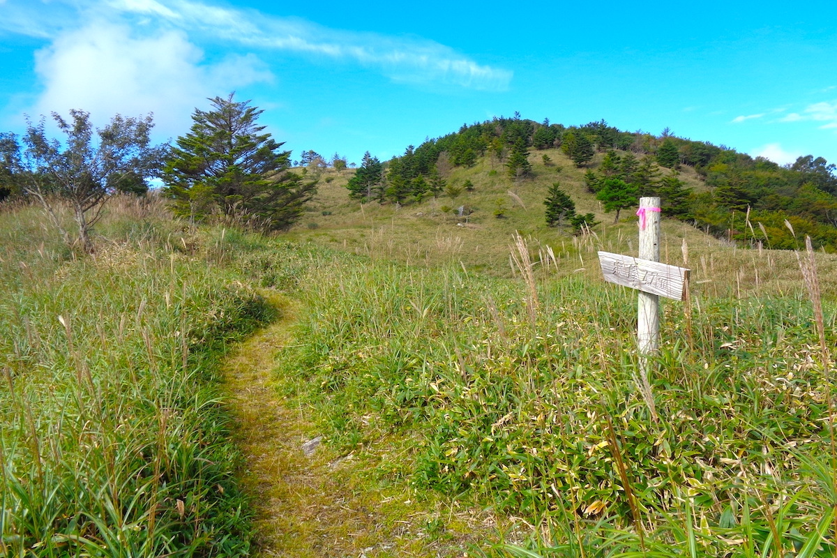
From the pass top, instead of taking the eastward trail to Ochiai Pass Overlook, take the trail westward that is on the other side of the road which starts to the right of the pass marker post.

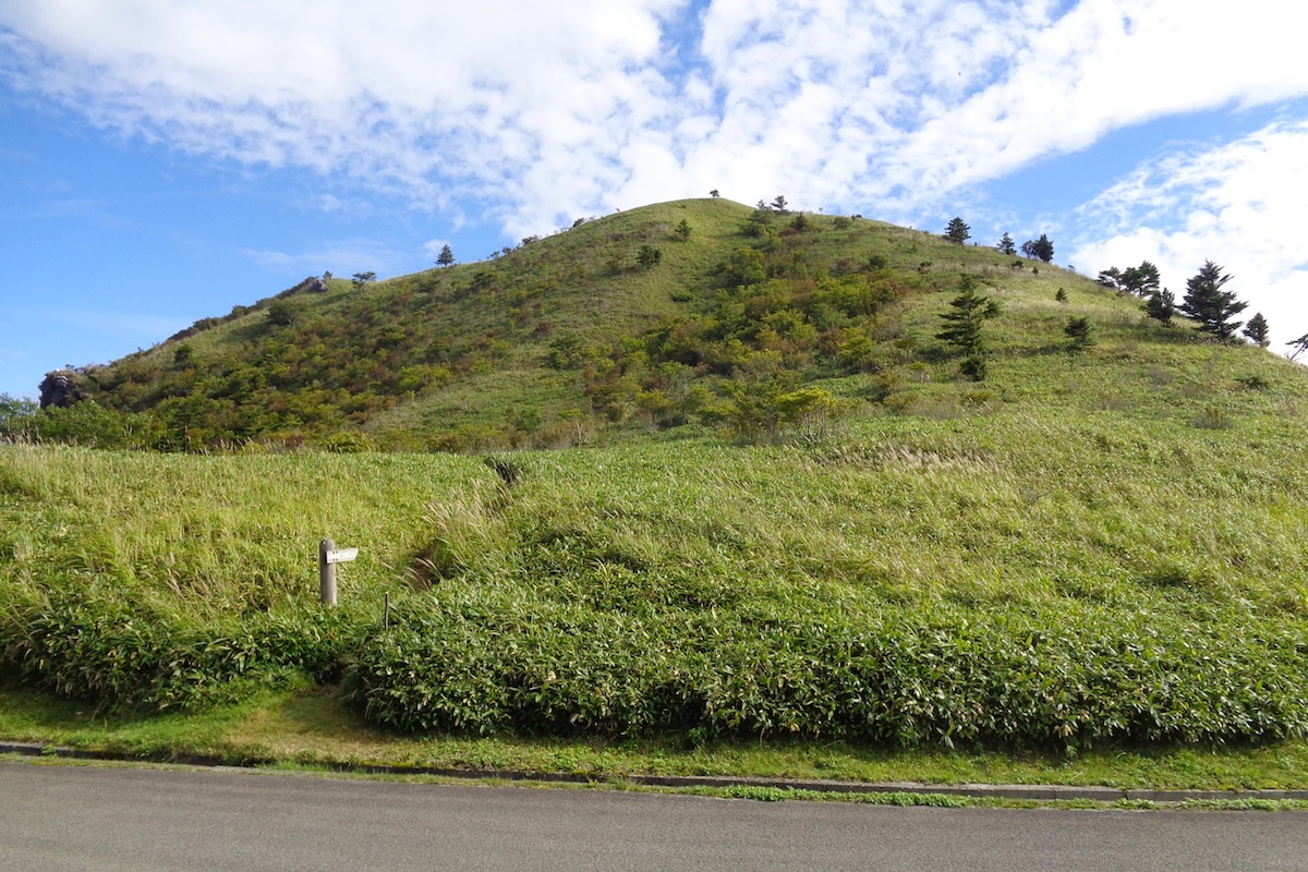
Looking out to the west the rounded, tree-less top of the 1683m high Ochi-hage can be easily seen in the distance.
The first 15 minutes of this trail is mostly level and goes through a meadow of thick sasa grass. You will probably be alone since this is not such a popular hiking area, and the tranquil isolation amongst the expansive natural scenery feels heavenly.
After a couple gentle hills the trail leads into some forest and it starts to become steeper. The next 15-20 minutes is uphill, but not too particularly steep. As you get near the top, the trees start to thin out.
Spectacular views of Iya from Ochi-hage
There is no sign marking the top of Ochi-hage, but there are several large stones which peek out from the thick sasa-grass that are great to take a well deserved break upon.

The “hage” name of this rounded hilltop means “bald”, which is fitting since there are practically no trees up here. Accordingly, expansive views lead out in every direction across the whole Iya Valley and central Shikoku.
To the north the wedge-shaped Mt. Eboshi can be seen, and in Part 3 we continue further beyond Ochi-hage along the ridge to this neighboring mountain.
For more information in English about hiking in the Iya Valley, including trail maps for routes from Ochiai Pass, check the Hiking Portal section of the IyaTime website:
https://www.iyatime.com/hiking-portal
(Text & Photos by: Shaun Lamzy)
Related Posts
-
Exploring Oboke Gorge – Part 2 | A Place for Food, Fun… and Monsters?!
The thrilling cliffs of Oboke Gorge are formed by the mighty Yoshino River as it cuts its way throug
2023.03.21

-
Exploring Oboke Gorge – Part 1 | A Natural Wonder of Miyoshi City
The mighty Yoshino River flows across much of Shikoku, and as it cuts its way through the rugged mou
2023.03.20
-
Iya Kanko Ryokan – Part 3 | Inheriting the Tastes of the Iya Valley
Just a few minute walk from the famed Kazurabashi Vine Bridge, the Iya Kanko Ryokan has been welcomi
2023.03.19
-
Iya Kanko Ryokan – Part 2 | A Family-Run Business Where Life is a Juggle
The Kazurabashi Vine Bridge is one of the most renowned sights of the Iya Valley, and just a couple
2023.03.18
-
Iya Kanko Ryokan – Part 1 | A Traditional Inn near the Kazurabashi Vine Bridge
Acclaimed as one of Japan’s Three Unusual Bridges, the Kazurabashi Vine Bridge is one of the most fa
2023.03.17
-
The Shikoku “Yukigassen” Snowball Fight – Part 2 | The Heat of the Battle in Icy Conditions
The 19th annual “Yukigassen” Snowball Fight Tournament was held recently in the deep mountains of Mi
2023.02.19