


Enjoying Ochiai Pass – Part 3 | A Challenging Hike to Mt. Eboshi
2022.10.12
As the highest drivable point in Tokushima’s Miyoshi City, the 1520m Ochiai Pass is also the second highest mountain pass in Shikoku. Offering amazing views into the Iya Valley, there are also hiking trails of various lengths and difficulty which lead off from the pass to the neighboring mountains.
Hiking along Iya’s Northern Ridge
In Part 2 we described a couple shorter hikes which can be done by going in either direction along the ridge from Ochiai Pass.
If looking for a little more of a challenge, consider hiking further out to Mt Eboshi, which is about one and a half hours beyond Ochi-hage (as described in Part 2).
From the top of Ochi-hage, the wedge shaped summit of Mt Eboshi can be seen to the north. The mountain takes this name because its shape resembles a traditional Japanese hat called an “eboshi” (“crow’s cap”).
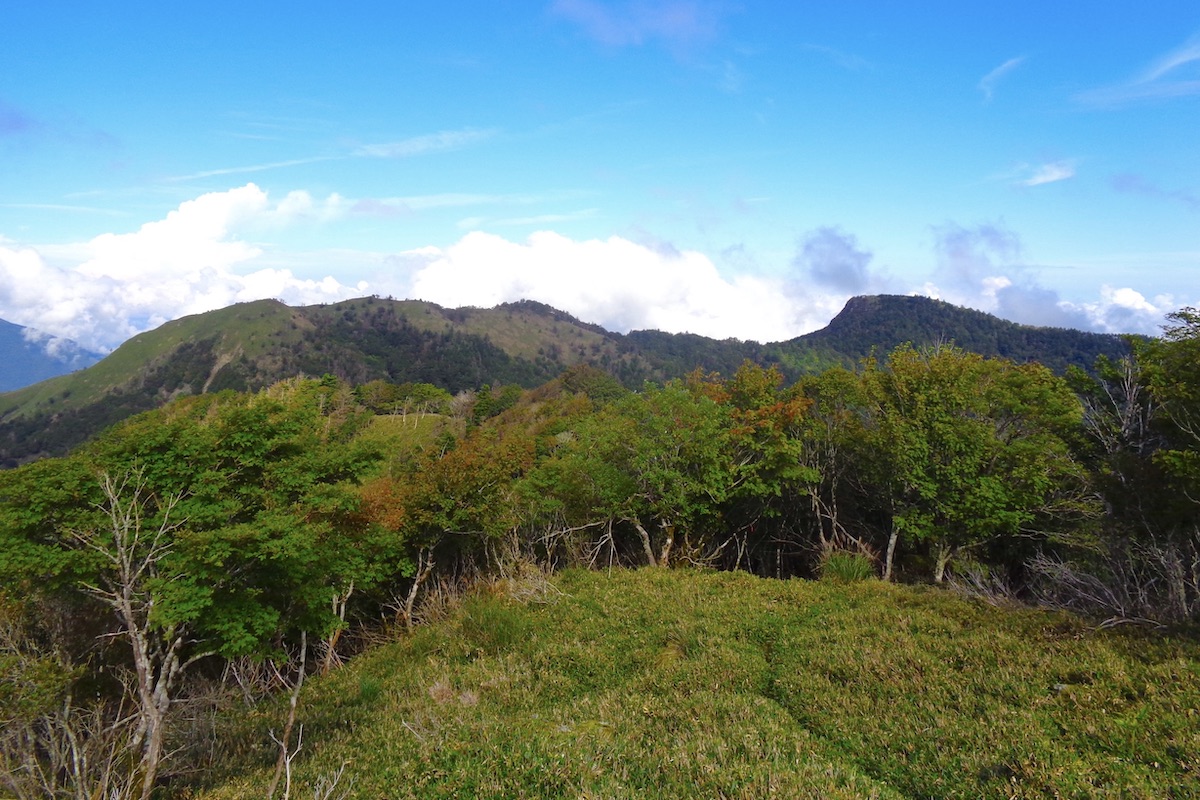
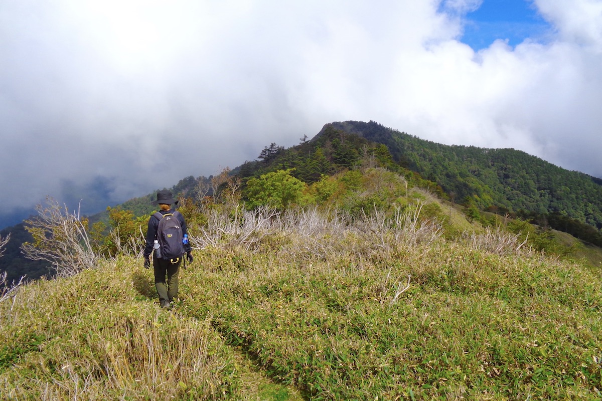
To the west of Ochi-hage is the rounded top of Mae-Eboshi (which means “In front of Eboshi”), and you will first need to follow the trail along the ridge and cross this hilltop on the way to Mt Eboshi.
Westward from Ochi-hage
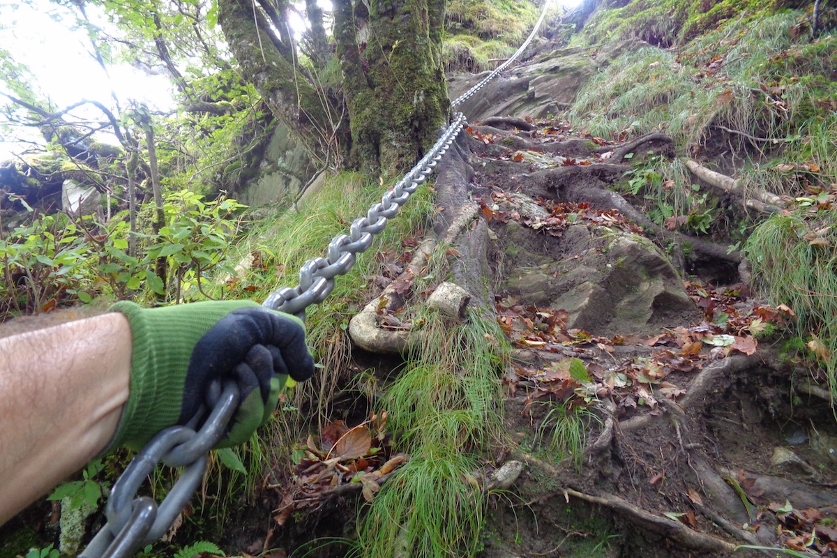
The trail west from Ochi-hage enters the forest and can be somewhat steep at times. About 5 minutes into this section there is a chain installed to help descend because it is too steep to do without it. Having gloves would be helpful.
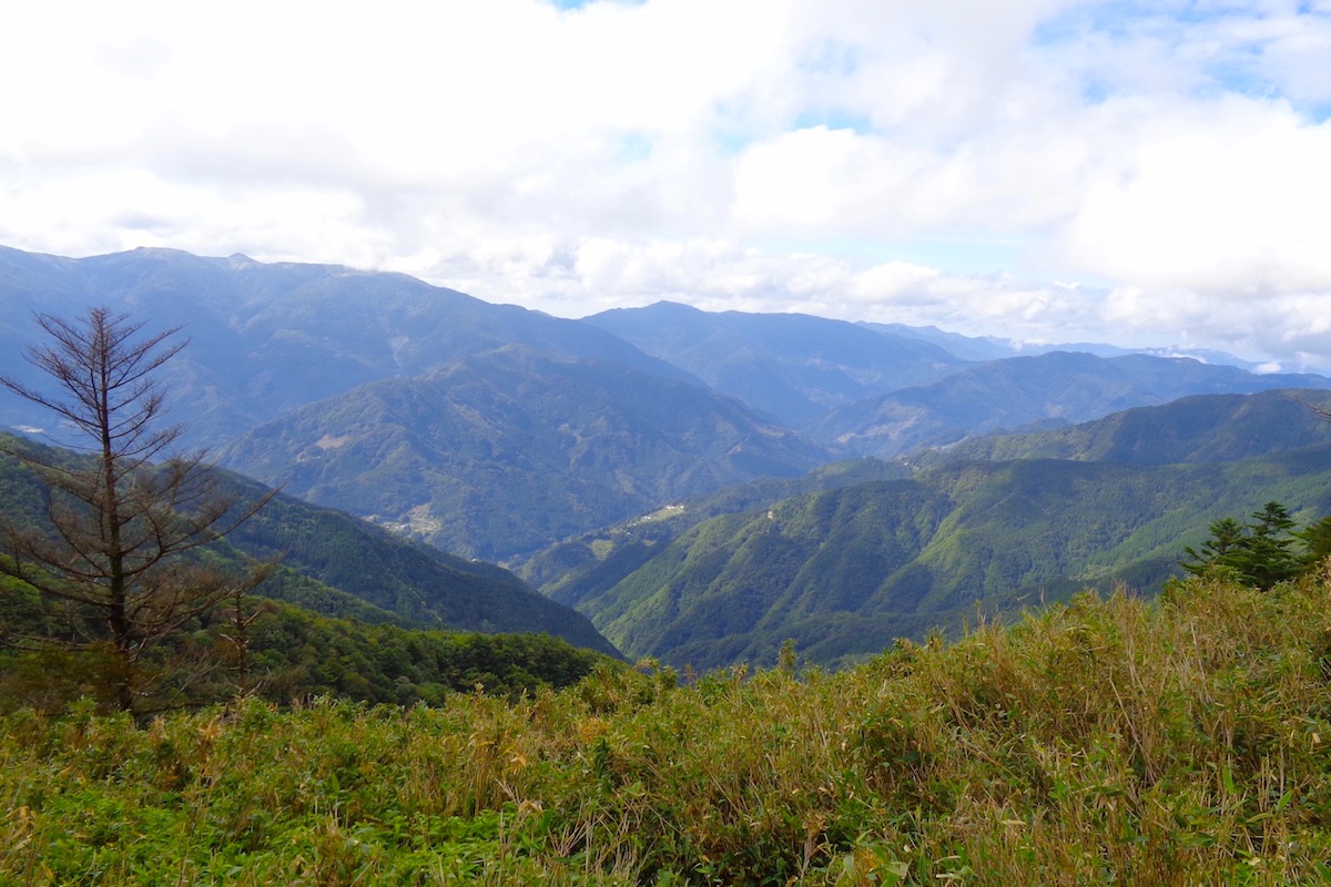
The trail is fairly well marked and some viewpoints appear here and there through the trees. At one point is a clear view of Kurishido Village in the Iya Valley.
There are not many level points along this trail as it follows the ridge top, so you will usually be going either up or down.
The final climb up to Mae-Eboshi can be steep at times, and once you get above the tree-line it takes only a few more minutes to reach the top.
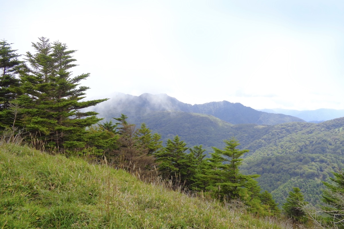
From Ochi-Hage it takes about 45 minutes to reach the 1660m summit of Mae-Eboshi. The view from here is pretty awesome looking back to Ochi-hage to the east, and Mt Eboshi directly to the north. To the southwest is the bald-top peak of Mt Kanpo, and it is also possible to follow the ridge trail in that direction to go there instead.

For Mt. Eboshi, the marker sign at the top of Mae-Eboshi says it is only 1km away, but the trail seems like it is farther than this, and it takes about 50 minutes to hike this next section to the top os Eboshi.
Climbing Mt Eboshi
Follow the trail north from Mae-Eboshi and re-enter the forest. It can be steep in several places along here, and if the ground is wet then it can also be very slippery. Having a hiking pole would be helpful.
The trail goes in and out of the forest and is constantly up and down over the uneven ridge. About half-way is a small peak with a nice view of Eboshi and the surrounding mountains.
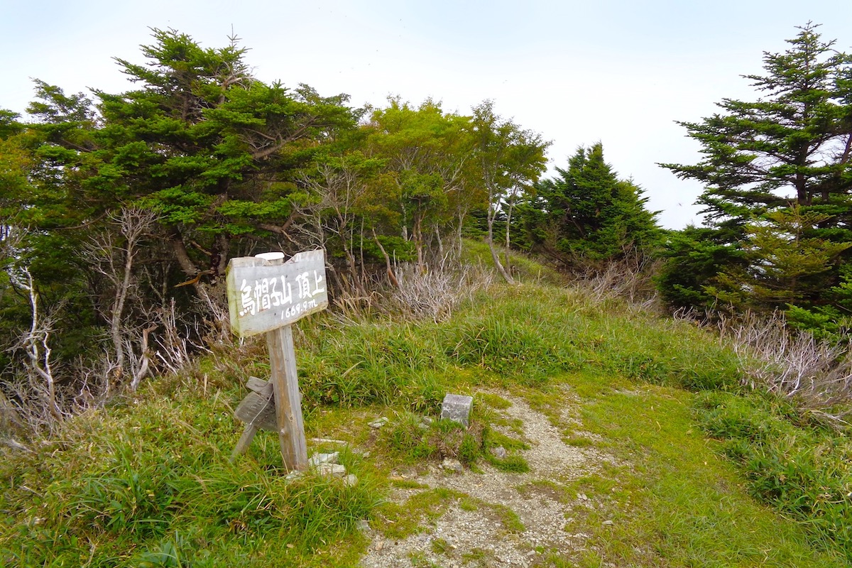
Though the trail is not particularly difficult, the final section up to the top of Mt Eboshi is a rather steep climb that takes about 10-15 minutes.
As you get near the top, the trees open up and a sign notes the 1669.9m summit.
Enjoying the a panorama of Miyoshi City
Even though it is a lovely mountain with a rewarding hike, Mt. Eboshi is not a particularly popular mountain, so you will probably be alone at the top.
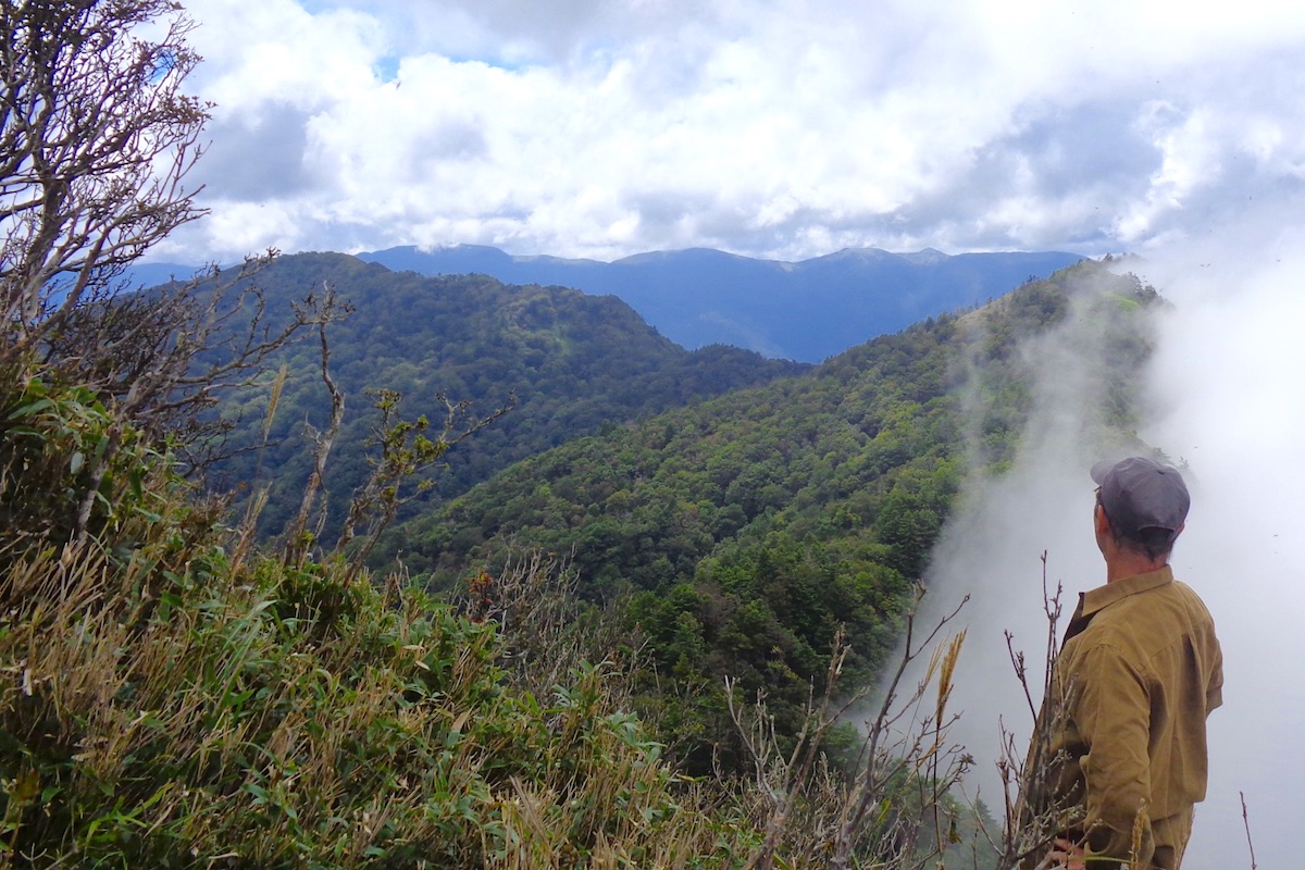
The view from the summit looks out to the south, and you can easily trace the route you have taken from Ochiai Pass.
From the summit sign post, follow the trail westward (to the left) for about a minute and you will reach the cliff-top of the Mt. Eboshi’s wedge.
From here the view is even more superb looking off to the south, west, and north across the misty mountains of Miyoshi City and beyond.
For more information in English about hiking in the Iya Valley, including trail maps for Mt. Eboshi, check the Hiking Portal section of the IyaTime website:
https://www.iyatime.com/hiking-portal
(Text & Photos by: Shaun Lamzy)
Related Posts
-
Exploring Oboke Gorge – Part 2 | A Place for Food, Fun… and Monsters?!
The thrilling cliffs of Oboke Gorge are formed by the mighty Yoshino River as it cuts its way throug
2023.03.21

-
Exploring Oboke Gorge – Part 1 | A Natural Wonder of Miyoshi City
The mighty Yoshino River flows across much of Shikoku, and as it cuts its way through the rugged mou
2023.03.20
-
Iya Kanko Ryokan – Part 3 | Inheriting the Tastes of the Iya Valley
Just a few minute walk from the famed Kazurabashi Vine Bridge, the Iya Kanko Ryokan has been welcomi
2023.03.19
-
Iya Kanko Ryokan – Part 2 | A Family-Run Business Where Life is a Juggle
The Kazurabashi Vine Bridge is one of the most renowned sights of the Iya Valley, and just a couple
2023.03.18
-
Iya Kanko Ryokan – Part 1 | A Traditional Inn near the Kazurabashi Vine Bridge
Acclaimed as one of Japan’s Three Unusual Bridges, the Kazurabashi Vine Bridge is one of the most fa
2023.03.17
-
The Shikoku “Yukigassen” Snowball Fight – Part 2 | The Heat of the Battle in Icy Conditions
The 19th annual “Yukigassen” Snowball Fight Tournament was held recently in the deep mountains of Mi
2023.02.19