


Racing into the Sky – Part 2 | Miyoshi City Hosts the Mt. Kunimi Skyrunning Challenge
2022.01.04
The Oboke Gorge area of Miyoshi City hosted their first ever Skyrunning Competition on November 28th, with dozens of runners competing in a grueling race up and down the towering Mt. Kunimi.
The Race to the Sky Begins
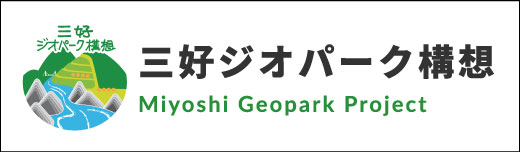
From the start of the 12.8km Mt. Kunimi Skyrace near Oboke Station the steepness of the course began immediately. The first 5km would be constantly uphill with a 1,200m elevation gain.
Every 15 seconds a new runner began and climbed a set of stairs that entered into the forest.
I quickly drove off in pursuit of the runners, taking the winding road up from Oboke to where the trail crossed the road at Arinomiya Shrine.
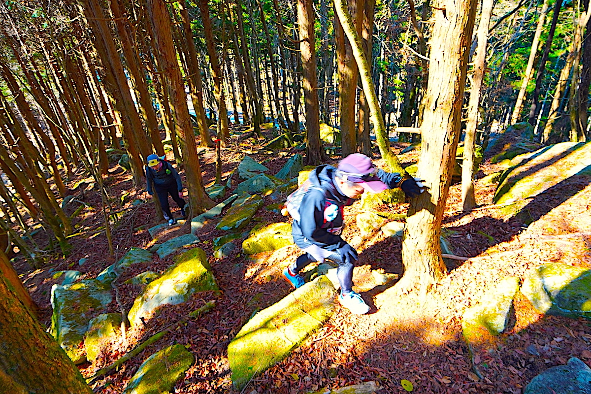
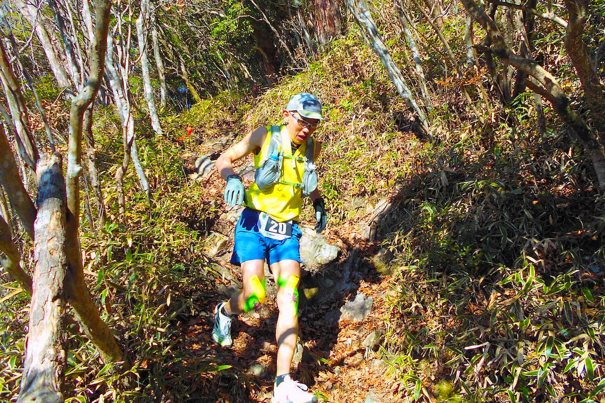
The Steepness of Mt. Kunimi Shows Itself
Upon passing Arinomiya Shrine the runners had not even completed the first kilometer yet, but they had already gained about 200m in elevation.
As they ascended the hundred or so steps up to the shrine, most runners were already heavily breathing. I even heard a few grumble as they passed, “Ahh, what’s with this course?”
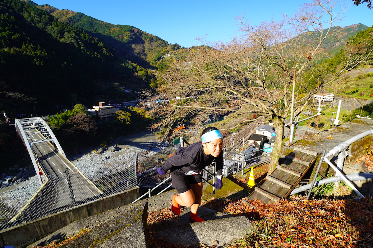
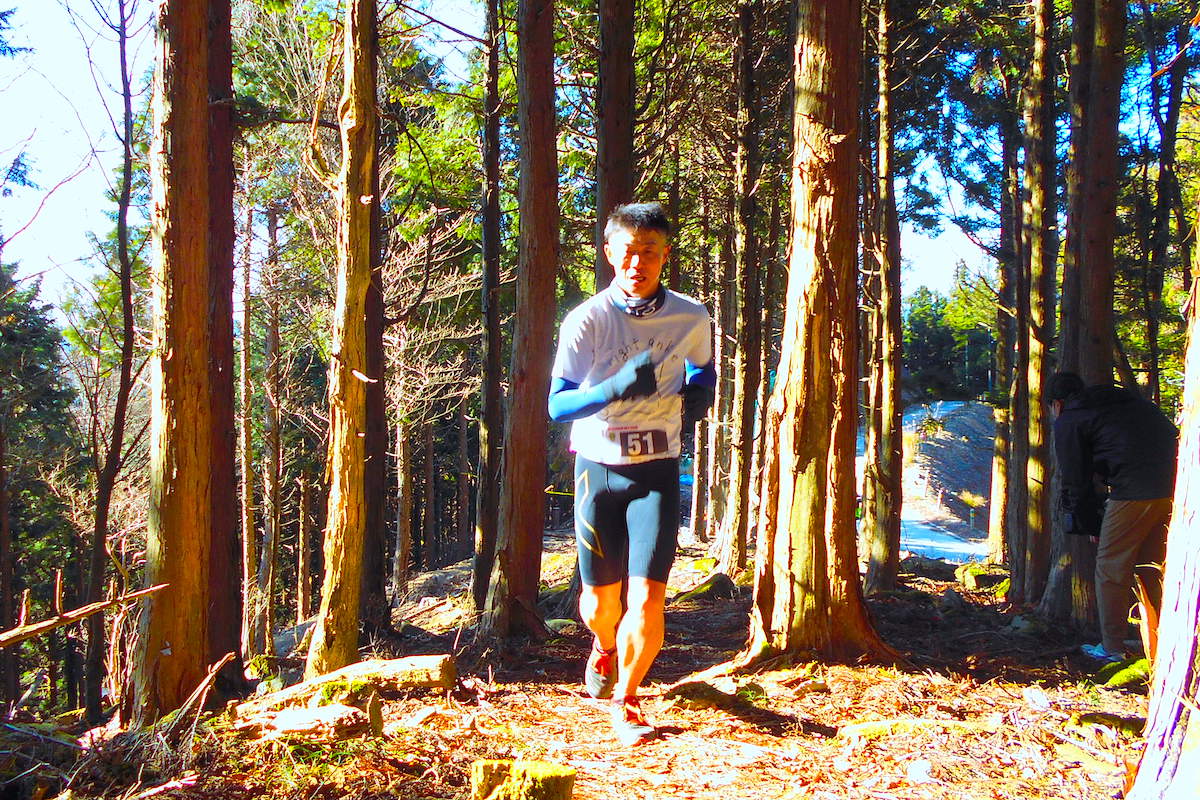
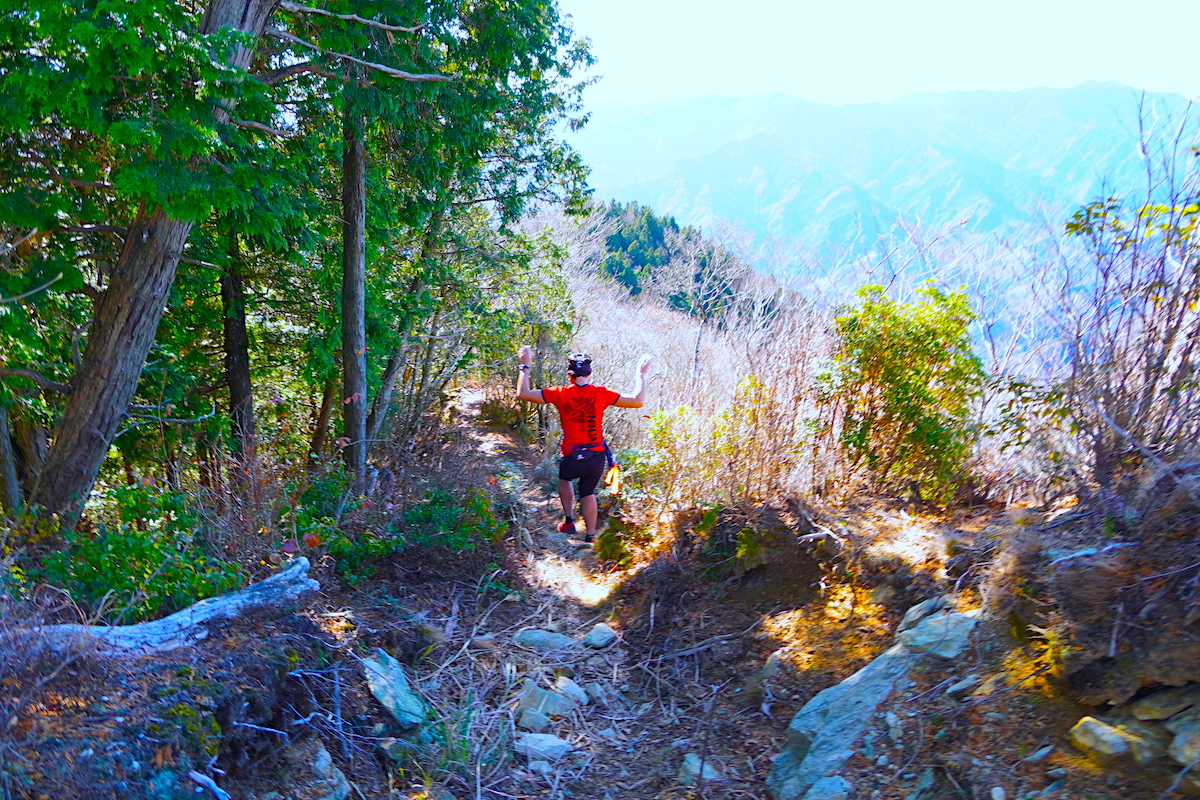
From here the trail led deeper into the forest as it unceasingly went up, up, and up.
Running up to the Sky
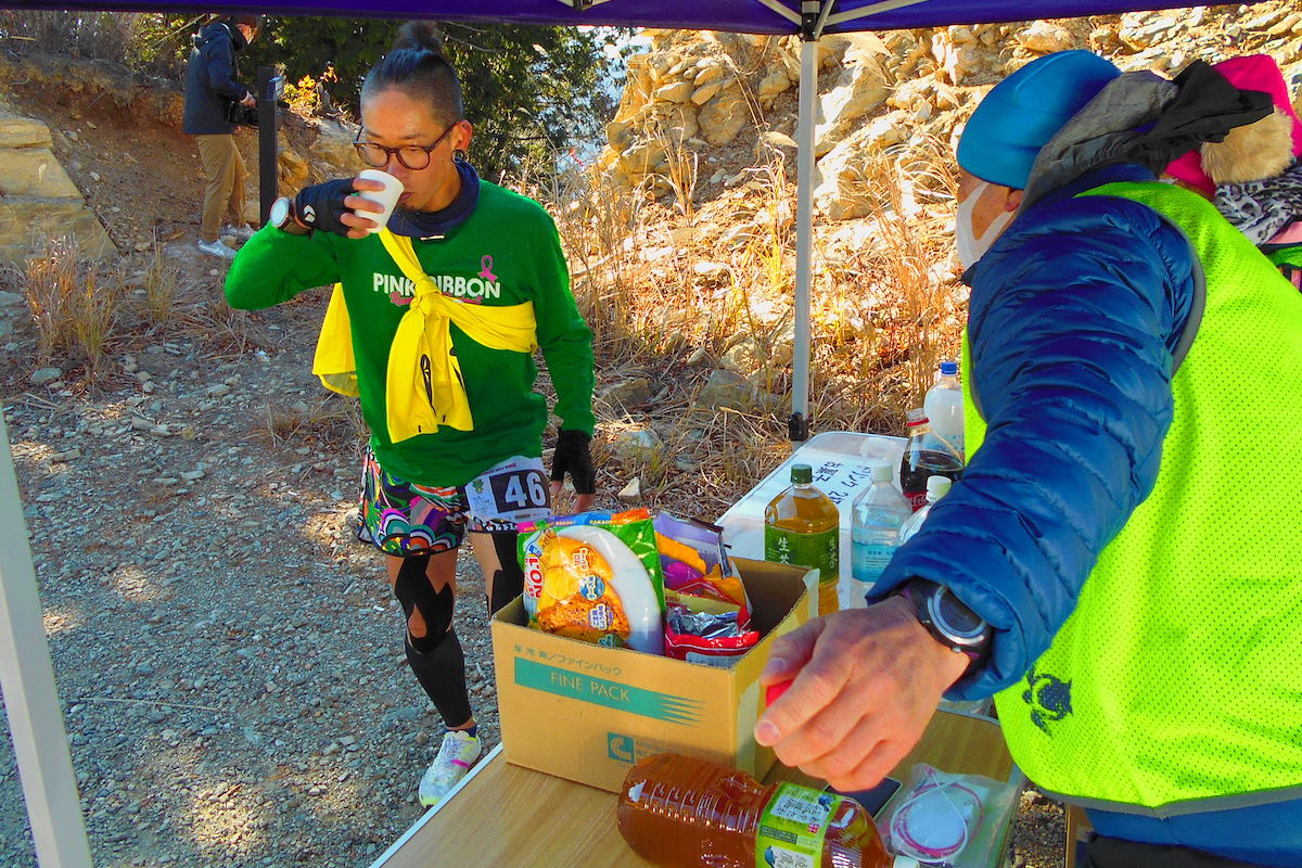
Looking to follow their progress, I drove off to higher up the mountain to where the trail crossed a remote logging road. It took me over 20 minutes to drive up to here and I was amazed that a few of the runners had already passed by. We were now at an elevation of about 1,150m, which means they had already ascended almost 1,000m!
As I watched them emerge from the forest onto the road, the looks on their faces were of focused concentration.

All were heavily panting and several welcomingly took a brief break to drink some water at the small aid station that was set up here.
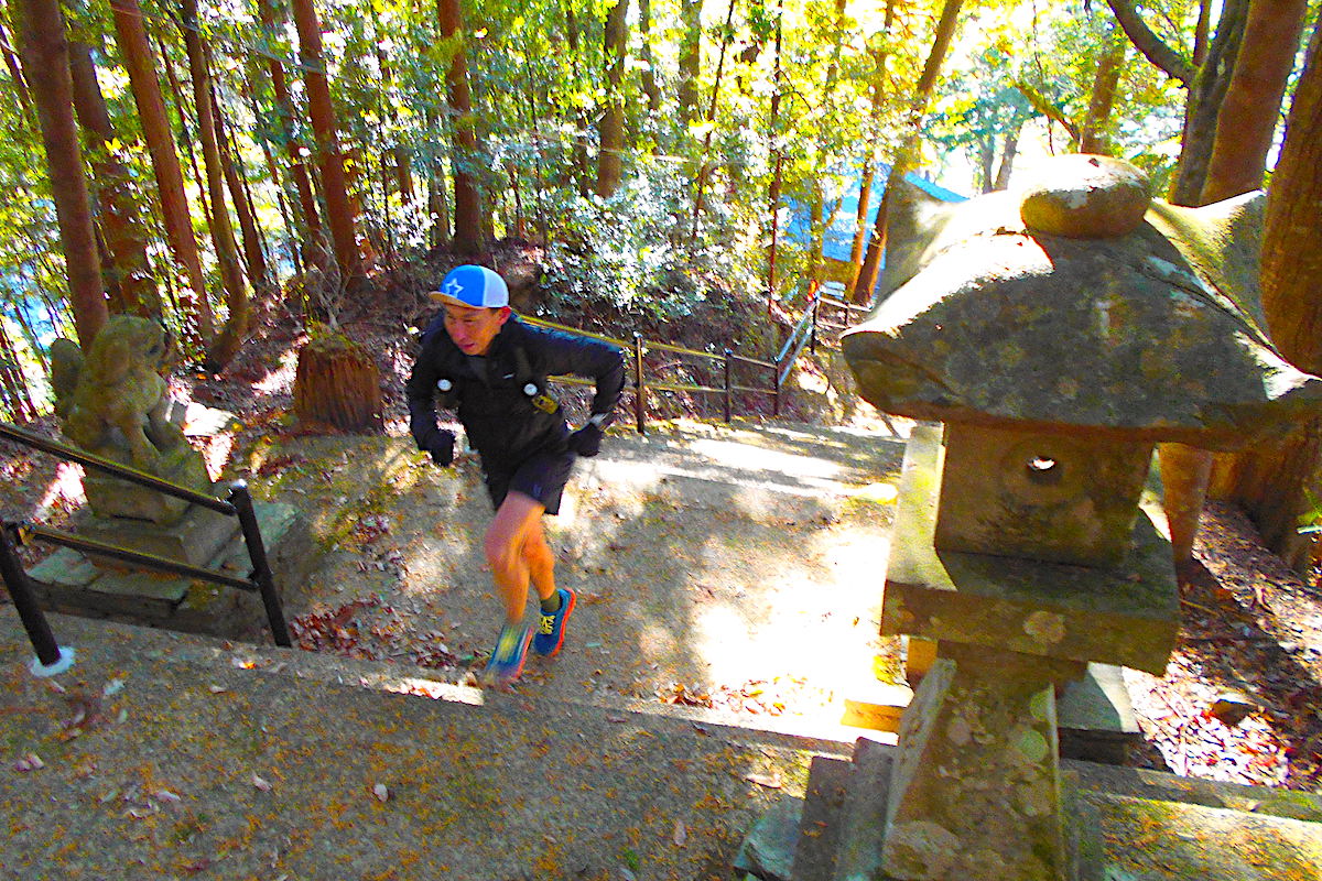
But their climb wasn’t over yet. The trail then re-entered the forest for the final 250m of ascent to the summit of Mt Kunimi.
No Time to Enjoy Mt. Kunimi’s View
The top of Mt. Kunimi reaches a height of 1,409m, and the name of the mountain translates as “Country View”. Such a name is fitting for this towering peak since the view from the summit looks far across all four prefectures of Shikoku.
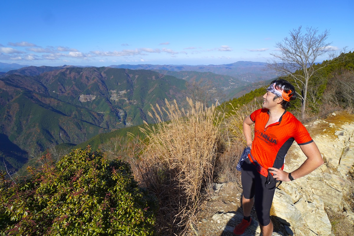
However, most runners were too tired or focused to enjoy the view all that much, however a few did allow themselves a moment to bask in the stunning panorama.
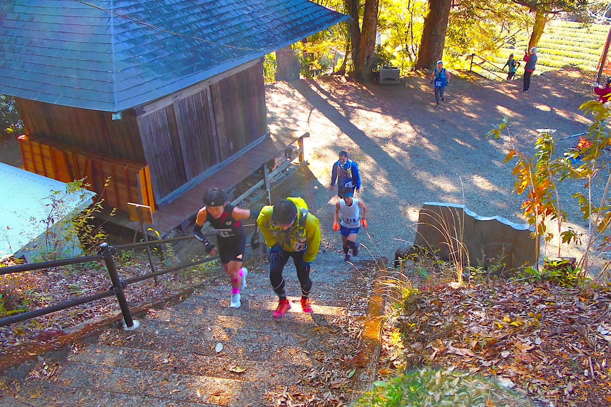
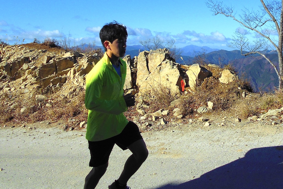
The Long Way Down to Oboke
From the top of Mt. Kunimi the long descent began down a different trail than the trail going up.
The descent posed a new challenge for the runners since their now tired legs had to navigate the steep and uneven terrain.
Runners blasted down the trail at much higher speeds than with going up. At times it seemed that they weren’t even running and instead were jumping and bouncing as they rapidly descended since it was so steep.
When I drove off back down the logging road to where it connected with the downward trail, I was amazed that I started to see several of the lead runners going by.

The course took them along this logging road for a couple kilometers to connect back onto the main trail at the aid station, so it was remarkable that they were already here as I left.
From the aid station they then continued with their steep descent back down to where they began near Oboke Station.
In Part 3 I will explain the results of this unbelievably challenging race.
For more information about Skyrunning Events, check the Associations webpages:
Japan Skyrunning Association
Shikoku Skyrunning Association
https://human-power.wixsite.com/shikoku-Skyrunning/field
Outdoor Sports Square
https://www.outdoor-sports.info/kunimiyama-skyrunning
(Text by: Shaun Lamzy, Photos by: Shaun Lamzy & Akihiro Shono)
Related Posts
-
Exploring Oboke Gorge – Part 2 | A Place for Food, Fun… and Monsters?!
The thrilling cliffs of Oboke Gorge are formed by the mighty Yoshino River as it cuts its way throug
2023.03.21

-
Exploring Oboke Gorge – Part 1 | A Natural Wonder of Miyoshi City
The mighty Yoshino River flows across much of Shikoku, and as it cuts its way through the rugged mou
2023.03.20
-
Iya Kanko Ryokan – Part 3 | Inheriting the Tastes of the Iya Valley
Just a few minute walk from the famed Kazurabashi Vine Bridge, the Iya Kanko Ryokan has been welcomi
2023.03.19
-
Iya Kanko Ryokan – Part 2 | A Family-Run Business Where Life is a Juggle
The Kazurabashi Vine Bridge is one of the most renowned sights of the Iya Valley, and just a couple
2023.03.18
-
Iya Kanko Ryokan – Part 1 | A Traditional Inn near the Kazurabashi Vine Bridge
Acclaimed as one of Japan’s Three Unusual Bridges, the Kazurabashi Vine Bridge is one of the most fa
2023.03.17
-
The Shikoku “Yukigassen” Snowball Fight – Part 2 | The Heat of the Battle in Icy Conditions
The 19th annual “Yukigassen” Snowball Fight Tournament was held recently in the deep mountains of Mi
2023.02.19