


Seeing the “Sea of Clouds” from Mt Kunimi Viewpoints in Miyoshi City- Part 1
2021.12.05
Both rare and spectacular, the natural phenomenon called the “Sea of Clouds” (“unkai” in Japanese) occurs when early morning fog settles into a valley and the surrounding mountains peak out like islands. Best viewed around sunrise, two viewpoints upon Miyoshi City’s Mt Kunimi offer a bird’s eye view into the Yoshino River valley, where this wondrous sight often occurs.
The Sea of Clouds phenomenon is not a common sight anywhere in Japan, but the Yoshino River area as it passes through Miyoshi City’s Oboke Gorge offers just the right conditions for this natural wonder to occur here more often than in other valleys.
For the Sea of Clouds (“unkai”) to happen, there must be just the right combination of wind and humidity, as well as for overnight temperatures to fall low enough for it to form. In this regard, early-to-mid spring and mid-to-late autumn provide the best conditions for it to happen, but in the Yoshino River area it can also happen in winter and even in summer sometimes.
Magical Morning Fog
The Sea of Clouds also only occurs around sunrise, if it does so at all, and after the sun has risen it will usually fade off within an hour or so. So getting up early is absolutely necessary.
Another important factor for seeing the Sea of Clouds is to get up high enough in elevation to watch it from above, usually 200-300 meters or more above the bottom of the valley.
The Mt. Kunimi Upper Trailhead Viewpoint
Standing 1409 meters tall, Mt Kunimi sits on the border of the Iya Valley and the Oboke Gorge areas of Miyoshi City. Without needing to hike to the summit, there are two places where you can simply drive to that are high up upon the side of Mt. Kunimi which are great for watching the Sea of Clouds.
To access the unkai viewpoint at Kunimi Upper Trailhead, it is about a 25 minute drive from central Nishi-Iya or about 30 minute drive from the Oboke Station area.
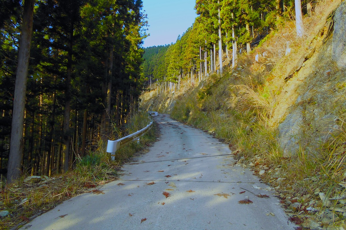
The final 10-15 minutes of the drive is along a narrow but paved logging road that twists and curves somewhat steeply uphill the whole way (full access directions will be given in Part 3 of this article).
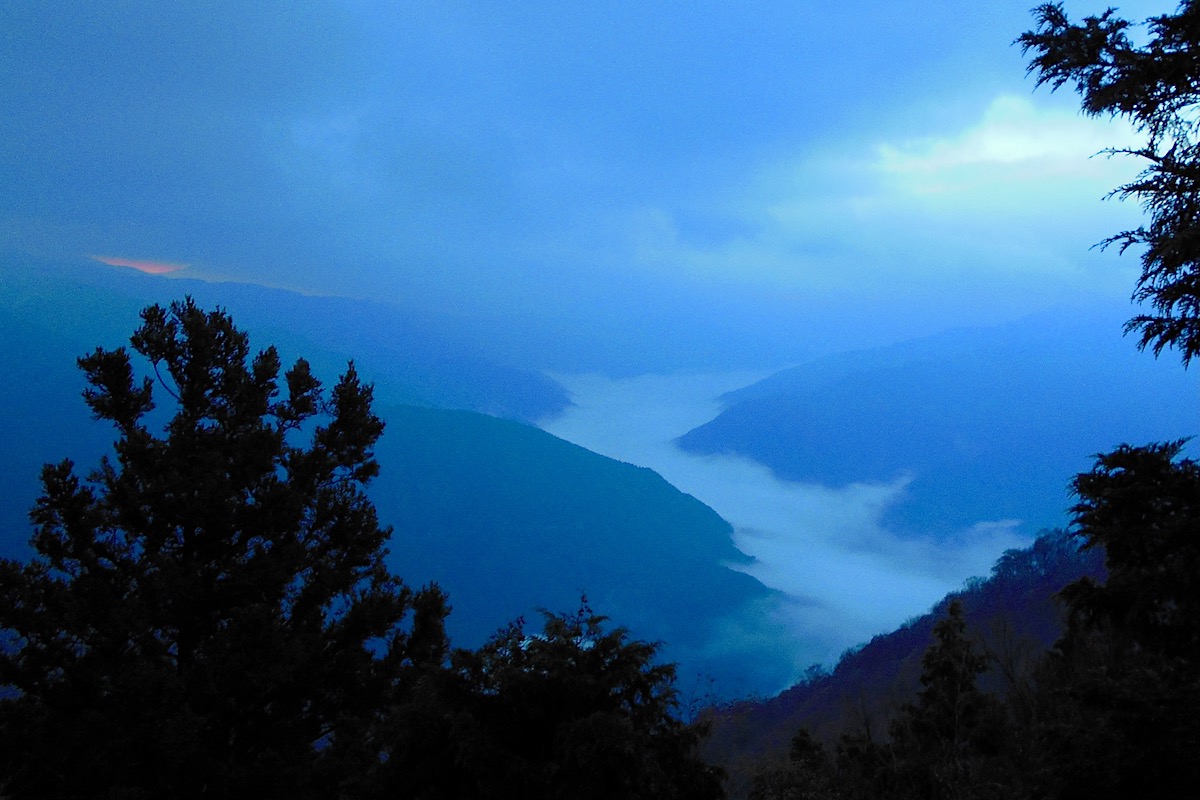
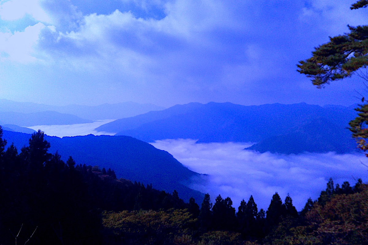
I had begun driving in the pre-dawn darkness, but it was now getting brighter outside when I finally reached the small parking area at the trailhead, and as luck would have it, I could see that the fog was settling in quite nicely this morning.
The view of the valley isn’t easily seen along the road here, but going a few meters up the concrete staircase for the start of the trail provides an expansive view of the valley below.

An Awesome View High Above the River
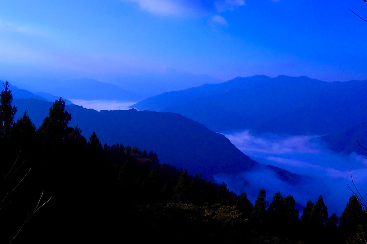
The view from the Kunimi Upper Trailhead is at an altitude of about 1050 meters, and being that the Yoshino River down below is at an elevation of around 150 meters, it means that this point is about 900 meters up.
For sure it was a beautiful sight, and the view of the fog filled valley stretched for over a dozen kilometers southward into neighboring Kochi Prefecture.
But as the day continued to brighten I could tell that the Sea of Clouds on this day wouldn’t diminish all that quickly, so after watching here for a bit I drove further along the narrow road for another 10 minutes to reach a second, more elusive point to see this magical sight.
In Part 2 I will explain another point on Mt Kunimi for seeing the Sea of Clouds.
For more information in English about Mt Kunimi (including maps which show the road up to Mt Kunimi and hiking trail information), check the Hiking Portal page on IyaTime website, and go to the bottom of the page for info about Mt Kunimi:
https://www.iyatime.com/hiking-portal
(Text & Photos by: Shaun Lamzy)
Related Posts
-
Exploring Oboke Gorge – Part 2 | A Place for Food, Fun… and Monsters?!
The thrilling cliffs of Oboke Gorge are formed by the mighty Yoshino River as it cuts its way throug
2023.03.21

-
Exploring Oboke Gorge – Part 1 | A Natural Wonder of Miyoshi City
The mighty Yoshino River flows across much of Shikoku, and as it cuts its way through the rugged mou
2023.03.20
-
Iya Kanko Ryokan – Part 3 | Inheriting the Tastes of the Iya Valley
Just a few minute walk from the famed Kazurabashi Vine Bridge, the Iya Kanko Ryokan has been welcomi
2023.03.19
-
Iya Kanko Ryokan – Part 2 | A Family-Run Business Where Life is a Juggle
The Kazurabashi Vine Bridge is one of the most renowned sights of the Iya Valley, and just a couple
2023.03.18
-
Iya Kanko Ryokan – Part 1 | A Traditional Inn near the Kazurabashi Vine Bridge
Acclaimed as one of Japan’s Three Unusual Bridges, the Kazurabashi Vine Bridge is one of the most fa
2023.03.17
-
The Shikoku “Yukigassen” Snowball Fight – Part 2 | The Heat of the Battle in Icy Conditions
The 19th annual “Yukigassen” Snowball Fight Tournament was held recently in the deep mountains of Mi
2023.02.19